
Founded 1 January 1612 Website Official website Local time Thursday 9:18 AM | Elevation 2,568 m (8,425 ft) Area 44 km² Population 14,442 (2015) | |
 | ||
Weather 15°C, Wind NE at 10 km/h, 82% Humidity | ||
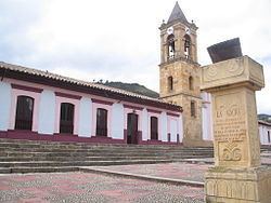
Gachancipá is a municipality and town of Colombia in the Central Savanna Province, part of the department of Cundinamarca. The urban centre is located on the Altiplano Cundiboyacense at 42 kilometres (26 mi) from the capital Bogotá. The municipality borders Guatavita and Tocancipá in the south, Sesquilé in the east, Zipaquirá in the west and Nemocón in the north.
Contents
Map of Gachancipa, Gachancip%C3%A1, Cundinamarca, Colombia
Etymology
The name Gachancipá comes from Chibcha and means "Pottery of the zipa".
History
The area of Gachancipá before the Spanish conquest was inhabited by the Muisca, organised in their loose Muisca Confederation. Gachancipá, as the name suggests, was ruled by the zipa based in Bacatá.
Modern Gachancipá was founded on January 1, 1612 but the founders are unknown.
In the late 18th century Muisca scholar José Domingo Duquesne was based in Gachancipá. A school in the town is named after him.
Economy
The economy of Gachancipá traditionally was centered around agriculture and livestock farming. In recent years flowers are cultivated in the municipality.