
Elevation 773 m (2,536 ft) Dialing code 0428 Postal code 33018 Patron saint Leonard of Noblac | Time zone CET (UTC+1) Saint day 6 November Dialling code 0428 | |
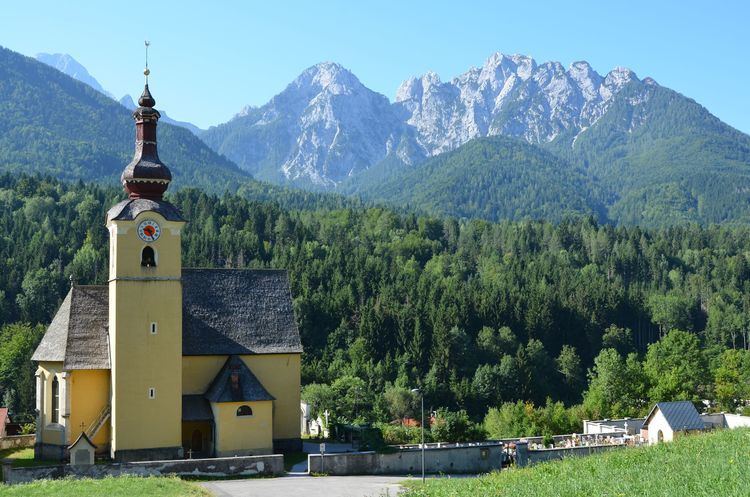 | ||
Fusine in Valromana (Slovene: Bela Peč, German: Weißenfels) is a frazione (fractional parish) of the comune of Tarvisio in the Province of Udine, in the Friuli-Venezia Giulia region of northeastern Italy.
Contents
Map of 33018 Fusine in Valromana, Province of Udine, Italy
Name
The locality takes its name from the Slovene (Fužine) and Friulian (Fusinis) term for the historic ironworks site. The Italian name is slight modification from the Friulan, with "in Valromana" added referring to an adjacent valley, which however is located a fair way off. The Slovene denotation Bela Peč, like the German name Weißenfels (literally "white rock"), refers to a historic castle erected by the Counts of Celje in the early 15th century.
Geography
The hamlet is located in the western Julian Alps, about 8 km (5.0 mi) east of the Tarvisio town centre and close to the tripoint where the borders of Slovenia, Austria, and Italy meet. It is a stop on highway SS 54, which leads from Tarvisio to the Slovenian border at the Fusine Saddle, continued by Slovenian highway No. 202 leading via Rateče to Podkoren and further down to the town of Kranjska Gora in the upper Sava (Sava Dolinka) Valley.
The mountains and lakes in the vicinity of Fusine in Valromana are popular destinations for mountaineers and trekkers. The upper and lower lakes "Laghi di Fusine" fed by artesian springs on the north face of the 2,677 m (8,783 ft) high Mangart peak attract many tourists.
The area immediately surrounding both lakes is protected by the 45-hectare scenic natural park Parco naturale dei Laghi di Fusine. Meadows and pasture land above the lake belong to the Fusine in Valromana pasture cooperative. This area includes the entire valley with about 180 hectares of alpine land and 200 hectares of forest.
History
A first mining settlement was probably established about 1320, when the area was still part of the March of Carniola. Unlike the neighbouring villages in the west, this easternmost part of the Canal Valley was not included in the Carinthian possessions of the Prince-Bishops of Bamberg, granted to them by King Henry II of Germany in 1007.
In 1404, the reigning Ortenburg count Frederick III gave one Consuran Bartholomew the right to build a forge, which established the iron industry and instigated the settlement of German-speaking workers. Several more forges were operating within the village by 1456 when cooperation agreements were made with the Austrian House of Habsburg, which had inherited the estates from the last Celje count Ulrich II.
The Lordship of Weißenfels remained the northwesternmost part of the Habsburg Duchy of Carniola, from 1804 under the control of the Austrian Empire and Austria-Hungary until the end of World War I. According to the terms of the 1919 Treaty of Saint-Germain, it fell under the authority of the Kingdom of Italy.
In 1862 the German firm Göppinger & Co. patented a method of making steel chains without welds. The manufacturing of chain and other hardware items in Fusine in Valromana led the industrial company to become a "global player". A successful Italian foundry founded by Dr. Segri after the First World War, grew to have 300 employees by 1925. In 1976 the company reached a peak of 600 employees, and in 1995, the company employed about 300 people. In 1999, Pewag, Weissenfels, and KWB (Kettenwerk Brückl), three competing firms, combined under one roof creating the company Pewag Weißenfels International GmbH.