
Area 11.18 km² Local time Sunday 3:29 AM | District Niwa - Flower Sunflower Population 33,833 (Feb 2012) | |
 | ||
Region Chūbu regionTōkai region Weather 2°C, Wind N at 6 km/h, 77% Humidity | ||
Fusō (扶桑町, Fusō-chō) is a town located in Niwa District, Aichi Prefecture, Japan. As of 2012, the town had an estimated population of 33,833 and a population density of 3030 persons per km². The total area was 11.18 km².
Contents
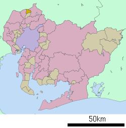
- Map of Fuso Niwa District Aichi Prefecture Japan
- Geography
- Neighboring municipalities
- History
- Railway
- Highway
- References
Map of Fuso, Niwa District, Aichi Prefecture, Japan
Geography
Fusō is located in the extreme northeast corner of Aichi Prefecture, bordering on Gifu Prefecture.
Neighboring municipalities
Aichi Prefecture
Gifu Prefecture
History
Fusō Village was established on October 1, 1906 through the merger of four small hamlets. It was raised to town status on August 1, 1952.
Railway
Highway
References
Fusō, Aichi Wikipedia(Text) CC BY-SA