
Population 3,265 (30 Sep 2016) | Area 188.4 km² Local time Sunday 1:32 AM | |
 | ||
Time zone Japan Standard Time (UTC+9) Weather -2°C, Wind W at 3 km/h, 72% Humidity District Furubira District, Hokkaido | ||
Furubira (古平町, Furubira-chō) is a town located in Furubira District, Shiribeshi Subprefecture, Hokkaido, Japan. As of 2016, the town had an estimated population of 3,265 and a density of 17 persons per km². The total area is 188.41 square kilometres (72.75 sq mi).
Contents
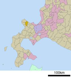
- Map of Furubira Furubira District Hokkaido Prefecture Japan
- Geography
- Neighboring municipalities
- History
- Economy
- Education
- References
Map of Furubira, Furubira District, Hokkaido Prefecture, Japan
Geography
Furubira occupies the eastern end of the north coast of the Shakotan Peninsula facing the Japan Sea. The town is largely built around the Furubira River, which runs from the highlands of the Shakotan Peninsula into the Japan Sea.
Neighboring municipalities
History
Furubira was established as one of many Pacific herring fishing settlements in the region at the beginning of the Edo period (1603 – 1868). The town was formally incorporated in 1902.
Economy
Manganese was once mined at the head of the Furubira River; mining ceased in the town in 1984. The mine was located at Inakuraishi.
The Port of Furubira, located near Cape Maruyama, is an active fishing port. Shrimp, Alaska pollack, and saltwater clams are a mainstay of the economy. The Furubira River provides irrigation for the production of rice, potatoes, and soy beans. Beef, pork, and poultry are also raised in the town.
Education
Hokkaido Furubira High School closed in 2012.