
- elevation 951 m (3,120 ft) Length 125 km | - elevation 11 m (36 ft) | |
 | ||
- left Surprise River, Loddon River, Jane River - right Collingwood River, Lucan River, Andrew River - location | ||
The franklin river blockade 1983 tasmania part 1 of 2
The Franklin River is a major perennial river located in the Central Highlands and western regions of Tasmania, Australia. The river is located in the Franklin-Gordon Wild Rivers National Park at the mid northern area of the Tasmanian Wilderness World Heritage Area. Its source is situated at the western edge of the Central Highlands and it flows west towards the West Coast.
Contents
- The franklin river blockade 1983 tasmania part 1 of 2
- Map of Franklin River Southwest TAS Australia
- Rafting the franklin river
- Location and features
- Named places on the Franklin
- Franklin River conservation battle
- References
Map of Franklin River, Southwest TAS, Australia
The river is named in honour of Sir John Franklin, a Governor of Tasmania, who later died searching for the Northwest Passage.
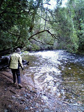
Rafting the franklin river
Location and features
The river rises below Mount Hugel west of Derwent Bridge on the western slopes of the Central Highlands and flows generally west and south through remote and rugged mountainous country until meeting its confluence with the Gordon River. From source to mouth the river is joined by sixteen tributaries including the Surprise, Collingwood, Lucan, Loddon, Andrew and the Jane rivers. In its upper reaches, the Franklin is impounded by two reservoirs, Lake Undine and Lake Dixon. The river is crossed by the Lyell Highway, also in its upper reaches. There are some archaeological sites that have identified pre-European activity. The upper reaches of the Franklin River were traversed by explorers in the nineteenth century, in their attempts to access Frenchmans Cap.
In the early twentieth century, access to the river was mostly pine logging in the lower reaches.
In the middle of the century, adventurous canoers sought to conquer the river's formidable challenges. The book Shooting The Franklin : Early canoeing on Tasmania's wild rivers identifies three trips in the 1950s.
Named places on the Franklin
In the case of earlier travellers, few locations of the river were named at all. During his initial journeys down the river, Bob Brown submitted names for some features. Before and since, rafters and canoers have added names for many of the bends and rapids on the river:
Franklin River conservation battle
In the 1980s, the Franklin River become synonymous with Australia's largest conservation battle of the time, the movement to save the Franklin from the Hydro Tasmania proposed hydro-electric power scheme.
The focus on the dam and the issues of wilderness experience led to the development of people utilising the river at levels never previously experienced. The result of a drowning on the river led to stricter guidelines for users of the river. Richard Flanagan's Death of a River Guide is a fictional account of a drowning, by a writer with an academic and historical understanding of the area.