
Topo map NTS 011/K09 Prominence 80 m Parent range Cape Breton Highlands | Elevation 430 m Easiest route Hiking | |
 | ||
Similar Skyline Trail, Pollett's Cove, North Highlands Communi, Louisbourg Lighthouse, Cabots Landing Provincial | ||
Franey Mountain is located in Victoria County, in the Canadian province of Nova Scotia, within Cape Breton Highlands National Park. Franey Mountain is part of the Cape Breton Highlands plateau and is located 4.5 kilometres (2.8 mi) west of Ingonish, Cape Breton Island. The elevation of the mountain is 430 metres (1,410 ft). It is the highpoint of the massif between Dundas Brook and Clyburn Brook.
Contents
Map of Franey Mountain, Victoria, Subd. A, NS, Canada
HikingEdit
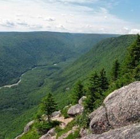
The mountain can be accessed by a hiking trail which leads to the summit, offering views over the open ocean from Cape Smokey in the east to Money Point in the north, with the Middle Head Peninsula jutting out into the Atlantic directly below. A dramatic view of the mountains, the sheer rocky face of Franey Mountain, and the Clyburn Brook winding through the valley, 425 metres (1,394 ft) below. The highpoint of the mountain can be difficult to locate as the summit is broad and flat.