Primary inflows Max. depth 244.4 m (802 ft) Surface elevation 715 m | Max. length 110 km (68 mi) Length 110 km | |
 | ||
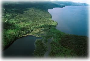
François Lake is a lake located in British Columbia about 30 kilometers south of Burns Lake and 10 kilometers west of Fraser Lake. The lake is 110 kilometers long and is the second longest natural lake entirely within British Columbia after Babine Lake. Nadina River is the inflow of the lake at the west and Stellako River is the outflow of the lake. The lake is popularly fished for its Rainbow Trout and Char.
Map of Fran%C3%A7ois Lake, British Columbia, Canada
Because of its shape, the lake was called Nidabun, meaning "lip lake." The French-Canadians mistook Nidaa for nedo, which meant "whiteman," and named it Lac des Français (meaning Lake of the French). The name Français later was altered to François.
References
François Lake Wikipedia(Text) CC BY-SA
