
Primary outflows Babine River Max. length 153 km (95 mi) Surface elevation 711 m Province British Columbia Outflow location Babine River | Basin countries Canada Length 153,000 m Max width 10,000 m Group Nechako Lakes | |
 | ||
Lynx spotted around babine lake b c
Babine Lake is the longest natural lake in British Columbia, Canada.
Contents
- Lynx spotted around babine lake b c
- Map of Babine Lake British Columbia Canada
- Fishing babine lake 2011 sockeye salmon
- Babine Portage
- References
Map of Babine Lake, British Columbia, Canada
Babine Lake is located northeast of the town of Burns Lake in central British Columbia, some 177 km (110 mi) west northwest of the city of Prince George. It is 153 km (95 mi) long, 2–10 km (1.2–6.2 mi) wide, and has a net area of 479 km2 (185 sq mi) and a total area of 495 km2 (191 sq mi), including islands on the lake which cover 16 km2 (6.2 sq mi). It lies at an elevation of 711 m (2,333 ft).
It drains northwest into the Babine River, an important tributary of the Skeena.
There are several provincial parks on Babine Lake:
Fishing babine lake 2011 sockeye salmon
Babine Portage
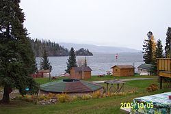
Babine Portage is a campsite located about 12 km north of the Portage Yekooche Reserve along a gravel road, on the west end of Babine Lake. The name originates from the 19th century, when the site was used as an entry point for canoes portaging to the Hudson's Bay Company post.
In the past, there were five cabins on the east side of the creek and seven on the west side, but in 2003, all but three were ignited by grass fires and burned down.
Although people from Tache, Fort St. James, and Prince George visit the area, it is mostly used by members of Yekooche First Nation, who spend most of the summer there before returning to Portage Reserve in the fall. The lake provides them with salmon and kokanee, while moose, deer and bear hunting can be done nearby around Salt Lake, Frank's Meadow, and a lagoon west of the camp. People also fish at 4 Mile and 6 Mile Creek, east of the camp near Quarter Island. People from Yekooche rely on their catch from Babine Portage for winter food.
An important local tradition at Babine Portage involves t'es-ing up first-time visitors, which means to rub coal on their cheeks to ward off bad weather at the camp. (t'es means charcoal in the Babine language.)