
Admin. region Darmstadt Elevation 190-500 m (−1,450 ft) Area 16.1 km² Local time Saturday 4:32 AM Dialling code 06164 | Time zone CET/CEST (UTC+1/+2) Population 3,318 (30 Jun 2009) Postal code 64407 Administrative region Darmstadt | |
 | ||
Weather 7°C, Wind SW at 32 km/h, 79% Humidity | ||
Fränkisch-Crumbach is a community in the Odenwaldkreis (district) in Hesse, Germany.
Contents
- Map of FrC3A4nkisch Crumbach Germany
- Location
- Neighbouring communities
- Politics
- Mayor
- Buildings
- Transport
- References
Map of Fr%C3%A4nkisch-Crumbach, Germany
Location
Fränkisch-Crumbach lies in the middle Odenwald on the Gersprenz, which empties into the Main near Stockstadt am Main.
Neighbouring communities
Fränkisch-Crumbach borders in the northeast on the community of Brensbach, in the southeast on the community of Reichelsheim (both in the Odenwaldkreis), in the west on the town of Lindenfels (Kreis Bergstraße), in the northwest on the community of Fischbachtal and in the north on the town of Groß-Bieberau (both in Darmstadt-Dieburg).
Politics
The municipal election held on 26 March 2006 yielded the following results:
Mayor
Mayor Gerhard Maser (SPD) was re-elected in the runoff election on 6 March 2005 with 60.8% of the vote.
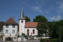
Buildings
Transport
The community is linked to the long-distance road network by Bundesstraße 38 (Weinheim–Roßdorf).