
Range Himalayas | Elevation 4,108 m Traversed by National Highway 1 | |
 | ||
Similar | ||
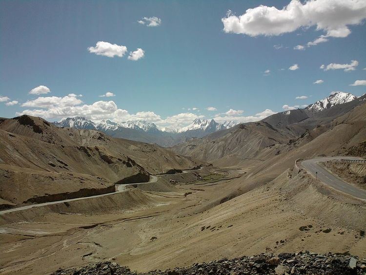
Fotu La (Hindi: फ़ोतु ला) or Fatu La is a mountain pass on the Srinagar-Leh highway in the Himalayas Zaskar Range in India. At an elevation of 4,108 metres (13,478 ft), it is the highest point on the highway, surpassing the famed Zoji La.
Map of Fotu La, 194106
Fotu La is one of two high mountain passes between Leh and Kargil, the other being Namika La.
Moving eastwards, the highway begins to descend towards the town of Lamayuru after Fotu La. There is a Prasar Bharati television relay station serving Lamayuru located on the pass.
References
Fotu La Wikipedia(Text) CC BY-SA