
Location India Range Himalayas | Elevation 5,328 m Traversed by Leh–Manali Highway | |
 | ||
Similar Bara‑lacha la, Lungalacha La, Khardung La, Chang La, Rohtang Pass | ||
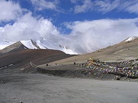
Taglang La, elevation 5,328 metres (17,480 ft), is a high mountain pass in Ladakh region of the Indian state of Jammu and Kashmir. As of August 2014, the Leh-Manali highway leading south from Upshi to Taglang La is paved, with the exception of a very short (approx 500m) unpaved section just north of the pass. The pass itself is paved.
Map of Taglang La, 194201
The elevation in metres, which is taken from a local sign, is in agreement with SRTM data. The sign claims 17,582 feet, which would be 5,359 metres, and incorrectly claims to be the world’s second highest motorable pass.
References
Taglang La Wikipedia(Text) CC BY-SA