
 | ||
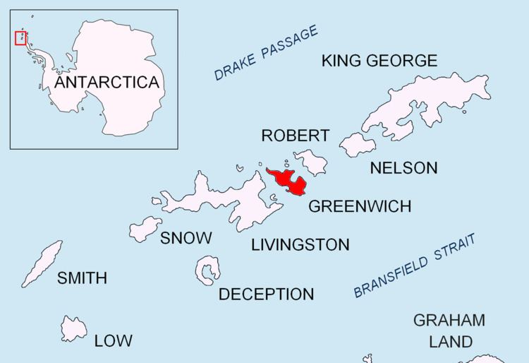
Fort Point is a conspicuous rocky point rising to 85 m and linked by a low 700 m isthmus to the southeast coast of Greenwich Island in the South Shetland Islands, Antarctica. The feature's name is descriptive, replacing the earlier version 'Castle Rock'.
Contents
Location
The point is located at 62°32′35″S 59°34′31″W which is 4.56 km east-northeast of Sartorius Point, 1.62 km east of St. Kiprian Peak and 4.9 km south by west of Santa Cruz Point. British mapping in 1968, Chilean in 1971, Argentine in 1980, and Bulgarian in 2005 and 2009.
Maps
References
Fort Point (Greenwich Island) Wikipedia(Text) CC BY-SA