
Country Canada Amalgamated 2009 Elevation 410 m Local time Tuesday 8:40 PM | Incorporated 1971 Postal code span V0C Area 13.26 km² Population 3,902 (2011) | |
 | ||
Time zone Mountain Time Zone (UTC−7) Weather -6°C, Wind NW at 10 km/h, 88% Humidity | ||
Fort Nelson is a community in northeast British Columbia, Canada within the Northern Rockies Regional Municipality (NRRM). It held town status prior to February 6, 2009 when it amalgamated with the former Northern Rockies Regional District to form the NRRM, becoming its administrative centre. The NRRM is the first regional municipality in the province.
Contents
- Map of Fort Nelson BC Canada
- History
- World War II
- Alaska Highway
- Post World War II
- Geography
- Wildlife
- Climate
- Demographics
- Economy
- Natural gas
- Forestry
- Tourism
- Attractions
- Government
- Roads
- Airport
- Rail
- Education
- References
Map of Fort Nelson, BC, Canada
The community lies east of the northern Rocky Mountains in the Peace River region along the Alaska Highway at mile 300. Fort Nelson is home to 3,902 residents, representing 70% of the NRRM's total population of 5,578.
The majority of Fort Nelson's economic activity has historically been concentrated in the energy and tourism industries, and until recently, forestry. The forests surrounding Fort Nelson are part of Canada's boreal forest. Fort Nelson is on the southwest edge of the Greater Sierra oil & gas field.
History
Fort Nelson, named in honour of the British naval hero Horatio Nelson, was established by The Northwest Trading Company in 1805 as a fur-trading post. Due to fires, floods and feuds, Fort Nelson is currently situated in its fifth location. The Fort Nelson Airport played a key role in developing Fort Nelson as a community. Yukon Southern Air Transport began chartering flights to the regional airport in 1935.
World War II
The Fort Nelson Airport was also a valuable asset for allied military forces in World War II, as it served as an airbase for the United States Air Force and for the Royal Canadian Air Force. Contrary to popular belief that the construction of the Alaska Highway commenced in Dawson Creek, Fort Nelson was the original mile 0 on the Alaska Highway because of the existence of a previously constructed road from Fort Saint John to Fort Nelson.
Alaska Highway
The United States Army built perhaps the most notable historical artifact in the area, the Alaska Highway. Construction began in 1942 out of a firm belief that Alaska faced significant threat of Japanese invasion. Highway construction attracted over 11,000 laborers to the area. After approximately nine lengthy and strenuous months, the highway was finally completed, making Fort Nelson a bustling service-center along the famous road. After the Japanese surrender of 1945, the U.S. Army ceded the Canadian portion of the highway to the Canadian government, which it made formally accessible to the public in 1948.
Post-World War II
In the years following World War II, the construction of the Alaska Highway, and the construction of the Fort Nelson Airport, Fort Nelson grew considerably as a community. In the early 1950s the first five acres were sold to locals, which marked the start of the community as a separate entity from the military. Oil- and gas-exploration in the early 1950s provided Fort Nelson with the industrial sector that it required to jump-start expansion of the community into what would eventually become the village of Fort Nelson in 1971. The 1960s also had Fort Nelson's education system formally offer grades 1-12 education. After the completion of BC Hydro's newly constructed natural-gas power plant to provide electricity to the region, Fort Nelson experienced true growth. A railroad was built up to Fort Nelson in the 1970s which allowed efficient transportation of the local industry's major products (lumber, oil, and gas) to larger markets in the south.
Geography
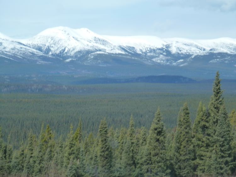
Fort Nelson lies near the confluence of Fort Nelson River (which took the name from the community), Muskwa River and Prophet River. The entire region of the Northern Rockies Regional Municipality, of which Fort Nelson is the largest community, constitutes 10% of the province’s total landmass. Fort Nelson is well known to be surrounded by mountainous beauty pertaining to the northern portion of the Rocky Mountains.
Wildlife
The Northern Rockies Regional Municipality is home to an extensive variety of wildlife which attracts many tourists and hunters to the region. Wildlife found in the area include animals such as moose, black bear, grizzly bear, caribou, deer (white-tail and mule), elk, bison, stone sheep, mountain goat, wolves, and several more. The region, especially the area around the Liard Hot Springs, is home to several bird species such as the golden eagle, the bald eagle, and the great horned owl.
Climate
Fort Nelson has a climate right on the boundary between a subarctic climate (Köppen Dfc) and a humid continental climate (Dfb). Winters, except when dry chinook winds blow from the Pacific Ocean tend to be severely cold and generally dry with snow depth of only 0.5 metres (19.7 in) typical owing to the dryness of the 1.77 metres (69.69 in) snowfall, while summers are warm and occasionally rainy, though spells of hot weather are rare.
Fort Nelson is colder than anywhere else in British Columbia from November through February, but the mean average temperature during the summer is warmer than coastal areas even far south such as Victoria and comparable to Vancouver.
Demographics
In the 2011 Census, the dissolved Town of Fort Nelson had a population of 3,902 living in 1,585 of its 1,804 total dwellings, a -13.6% change from its 2006 population of 4,514. With a land area of 13.26 km2 (5.12 sq mi), it had a population density of 294.27/km2 (762.2/sq mi) in 2011.
In 2005, Fort Nelson's median household income was $83,188, which is above the British Columbian provincial average of $52,709. Fort Nelson is the home to a very diverse group of residents with approximately 14% of the community's residents being of Aboriginal identity. Fort Nelson has also seen a large increase in the number of foreigners coming to the community, with substantial increases in number of residents from the Philippines. Fort Nelson is a fairly young community in comparison to the rest of the province, with 30.7% of the population being under the age of 19. Approximately 44% of Fort Nelson residents over the age of 15 have attained an education beyond a high school certificate or equivalent in the forms of trades, colleges, or universities.
Economy
Due to major increases and improvements to the oil and gas industry in the Horn River Basin, Fort Nelson has experienced substantial growth in recent years. Natural gas, forestry, tourism and agriculture make up the majority of local industry.
Natural gas
Unconventional gas exploration is the premier industry in Fort Nelson, employing a large percentage of Fort Nelson's community members. The region's natural gas industry centers around the Horn River Basin, Liard Basin, and the Cordova basin which all contain vast amounts of gas in shale rock formations. Many of the world's most recognizable oil and gas companies are operating in the region, including EnCana, Nexen, Apache, Imperial Oil, and several more. The most common form of gas extraction is the combination of horizontal drilling and hydraulic fracturing, in which a drill bit is first vertically, then horizontally inserted deep into the ground in an attempt to reach poorly accessible shale gas formations. As with any gas operation in North America, there are significant concerns to the environmental and social effects of the industry on the surrounding area. Large amounts of water are being extracted, most of which is withdrawn from nearby lakes and rivers, which continues to be a hot topic in the region and within the oil and gas industry.
Forestry
Fort Nelson is surrounded by vast plains and mountains of boreal forest. The relatively untouched timber supply was the contributing factor to companies such as Canfor constructing large factories that employed hundreds of people. In recent years, both the Canfor mill and the Tackama mill have completely ceased operations based on high costs and a struggling US housing market. The closure of the mills proved to be devastating for locals, displacing several hundreds of local employees and their families. At present, the oil and gas industry is responsible for the majority of forestry operations currently in progress in the region, based on its need for service roads and deforested operational land.
Tourism
Although very seasonal in Fort Nelson, tourism continues to be an important economic sector in Fort Nelson’s economy. Approximately 300,000 tourists, most of whom are retired RV travellers heading to or from Alaska, visit Fort Nelson on an annual basis. The Northern Rockies Regional Municipality is also home to several world-renowned tourist attractions such as the Liard Hot Springs, Muncho Lake Provincial Park, and the Alaska Highway. Hunting, fishing, snowmobiling, dog sledding, bird watching and hiking are all popular outdoor recreational activities that draw thousands of tourists to the region every year.
Attractions
On 18 June 2005, people in Fort Nelson held a water balloon fight with over 40000 water balloons being tossed in less than three minutes. At the time, it was a world record.
Government
Fort Nelson was originally incorporated as a village in 1971, but established itself as an unregistered community shortly before that. In 1960, based on significant growth in the oil and gas industry of the region, the Fort Nelson Improvement District was formed in order to provide community members with essential infrastructural needs such as water and sewer services. Harry Clarke was elected the first mayor of Fort Nelson in 1971 and since then, Fort Nelson has consistently elected one regional representative, although not always historically referred to as a mayor. In February 2009, citizens of the region voted heavily in favour of officially amalgamating the region’s governing bodies into The Northern Rockies Regional Municipality. The Northern Rockies Regional Municipality is the first of its kind in British Columbia.
Roads
Fort Nelson is located along Highway 97 (Alaska Highway), south of the intersection with Highway 77.
Greyhound Canada operates a bus depot in the community.
Airport
The Fort Nelson Regional Airport (YYE) is located about 8 km northeast of Fort Nelson. The airport is one of the fastest growing regional airport facilities in Canada. Fully serviced by Central Mountain Air, 7 days a week and up to 5 flights a day, passengers are able to connect to international markets through Edmonton (YEG), Calgary (YYC) and Vancouver (YVR) international airports.
Rail
CN Rail operates a former BC Rail line that has its northern terminus in Fort Nelson. It runs one train weekly.
Education
Fort Nelson is home to three public elementary schools (G.W. Carlson, and J.S. Clark, both grades K - 4, and R.L. Angus, grades 5 - 7) and one public high school (Fort Nelson Secondary School, grades 8 - 12), as well as an independent school owned and operated by the Fort Nelson First Nation (Chalo School). The Northern Lights College has a small campus situated in Fort Nelson that awards several trades certificates and diplomas to students.