
Traffic Automotive Length 2,414 m Toll 4 USD | Constructed 1980-1985 Character Highway Opened 23 November 1985 | |
 | ||
Similar Balti Harbor Tunnel, Francis Scott Key Bridge, Thomas J Hatem Memorial, Governor Harry W Nice Me, Chesapeake Bay Bridge | ||
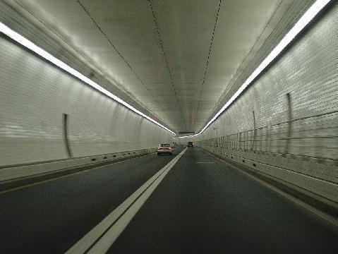
The fort mchenry tunnel baltimore md
The Fort McHenry Tunnel is a four-tube, bi-directional tunnel that carries traffic on Interstate 95 underneath the Baltimore Harbor. The lowest point in the Interstate System under water, the tunnel is named for nearby Fort McHenry.
Contents
- The fort mchenry tunnel baltimore md
- Map of Fort McHenry Tunnel Baltimore MD USA
- Location
- Design and construction
- References
Map of Fort McHenry Tunnel, Baltimore, MD, USA
The tunnel, which opened on November 23, 1985, closed a gap in I-95 between Maine and Florida. At the time of its opening it was the most expensive underwater tunnel project in the United States, but that figure has since been surpassed by the Big Dig project in Boston.
The Fort McHenry Tunnel was constructed from June 1980 to November 1985, at a cost of about $750 million. The tunnel's annual traffic in 2009 was 43.4 million vehicles. As of July 1, 2015, the toll rate for cars is $4.00 cash or $3.00 E-ZPass, paid in either direction. Vehicles with more than two axles pay additional amounts, up to $30.00 for six axles.
Location
The tunnel crosses the Patapsco River, just south of Fort McHenry and connects the Locust Point and Canton areas of Baltimore City.
Design and construction
The Fort McHenry Tunnel was opened on time and under its budget, and it continues to be a vital transportation link in the Mid-Atlantic region. Soon after the Fort McHenry Tunnel opened, the nearby Baltimore Harbor Tunnel, which had opened to traffic in 1957, was extensively rehabilitated.