
Country Canada Elevation 268 m Population 515 (2011) Area code 867 | Charter Community 1 April 1995 Area 47.14 km² Local time Tuesday 8:13 PM Number of airports 1 | |
 | ||
Weather -18°C, Wind N at 5 km/h, 71% Humidity | ||
Bike jumps fort good hope nt mp4
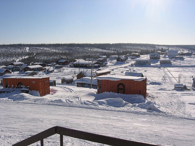
Fort Good Hope (or the Charter Community of K'asho Got'ine) is a charter community in the Sahtu Region of the Northwest Territories, Canada. It is located on a peninsula between Jackfish Creek and the east bank of the Mackenzie River, about 145 km (90 mi) northwest of Norman Wells. The two principal languages are North Slavey and English. Hunting and trapping are two major sources of income.
Contents
- Bike jumps fort good hope nt mp4
- Map of Fort Good Hope NT Canada
- Fort good hope volleyball tournament 1st set part 2 march 10th 2013
- Demographics
- Transportation
- First Nations
- Education
- Communication Infrastructure
- Climate
- References
Map of Fort Good Hope, NT, Canada
Fort good hope volleyball tournament 1st set part 2 march 10th 2013
Demographics
According to the 2011 Census the population was 515, a decrease of 7.5% from the 2006 Census. In 2006 the Aboriginal population was 515, of which 460 were North American Indians, 40 Métis people and 10 Inuit. In 2012 the Government of the Northwest Territories reported that the population was 559 with an average yearly growth rate of -0.5% from 2001.
Transportation
The only all season access is by air, Fort Good Hope Airport, with flights operated by North-Wright Airways from Inuvik, Norman Wells and Colville Lake. The community can be accessed in summer using the Mackenzie River. There is no passenger service and the route is primarily used by the Northern Transportation Company for the summer sealift. Winter access is possible via a winter road from Wrigley located further south. The NWT government is seeking federal funding to help extend the Mackenzie Highway from Wrigley to Tsiigehtchic, where it would connect with the Dempster Highway, as of winter 2014 at least eight major river crossings are in place for the new road, some of which are in use as winter crossings.
First Nations
Fort Good Hope is represented by the K’asho Go’tine Community Council and belong to the Sahtu Dene Council. Through the council they are in negotiations with the Government of Canada for a land claims settlement.
Education
Fort Good Hope currently has three institutes providing some form of education. For pre-school, there is the Fort Good Hope Daycare. Elementary, junior high and senior high school students attend Chief T'Selehye School. However, if one attends Aurora College Learning Centre, located in the town, in the developmental studies program one can, if required, upgrade their marks from high school or upgrade their academic courses that is required for Aurora College admission or college and university admission. Most students from town that graduate high school tend to explore the south to upgrade their academic courses for college/university admission, so they can get used to the different environment that can prospectively be their home for their post-secondary years.
Communication Infrastructure
Climate
Fort Good Hope experiences a subarctic climate, with long, bitterly cold winters and short, warm summers. The highest temperature ever recorded was 35.0 °C (95 °F) on 20 June 1911, 11 July 1920 and 5 July 1998. The coldest temperature ever recorded was −56.1 °C (−69 °F) on 31 January 1917 and 4 February 1947.