
Airport type Public Elevation AMSL 4,939 ft / 1,505 m 5,326 1,623 Elevation 1,505 m | 11/29 5,326 1,623 Asphalt Phone +1 970-482-6588 | |
 | ||
Address Fort Collins, CO 80524, USA Similar The Armstrong Hotel, Hilton Fort Collins, Best Western University, Visit Fort Collins, Northern Hotel | ||
Helicopter approach to old fort collins downtown airport
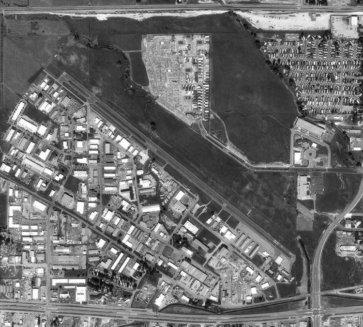
Fort Collins Downtown Airport (FAA LID: 3V5) was a public use airport located 2 nautical miles (3.7 km; 2.3 mi) east of the central business district of Fort Collins, a city in Larimer County, Colorado, United States. The airport closed on November 1, 2006.
Contents
History
The airport opened in 1966 and was known as Valley Airport. Sometime before 1976 it was renamed Fort Collins Airpark and the following year it was named Downtown Fort Collins Airport. It was located northwest of the intersection of East Mulberry and South Timberline Roads.
Facilities and aircraft
Fort Collins Downtown Airport was situated at an elevation of 4,939 feet (1,505 m) above mean sea level. It had one asphalt paved runway designated 11/29 which measured 5,326 by 44 feet (1,623 x 13 m). It also has a turf runway designated E/W which measured 3400 by 50 feet (1,036 x 15 m).
The airport had an average of 48 aircraft operations per day: 100% general aviation and <1% military aviation. There were 126 aircraft based at this airport: 90 single-engine, 20 multi-engine, 15 helicopters, and 1 glider.