
Country United States County Oneida FIPS code 36-26627 Elevation 434 m Population 1,535 (2010) Area code 315 | State New York Time zone Eastern (EST) (UTC-5) GNIS feature ID 0978964 Zip code 13338 Local time Tuesday 2:52 PM | |
 | ||
Weather -8°C, Wind N at 27 km/h, 96% Humidity Area 204.6 km² (199.9 km² Land / 4.662 km² Water) | ||
Forestport is a town in Oneida County, New York, United States. The population was 1,535 at the 2010 census.
Contents
- Map of Forestport NY 13338 USA
- History
- Geography
- Demographics
- Communities and locations in Forestport
- References
Map of Forestport, NY 13338, USA
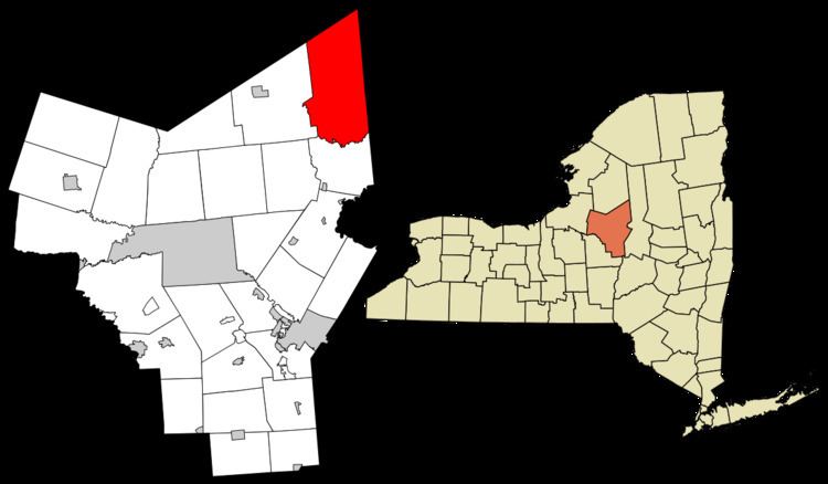
The Town of Forestport is located in the northeast corner of Oneida County. The northern part of the town is in the Adirondack Park.
History
Forestport was created from the Town of Remsen in 1869.
At the end of the 19th century, many of the town's population were found to be involved in a conspiracy to divert funds set aside for canal repair for the Black River Canal. Sections of the Black River Canal were actually dynamited so as to profit from repair work, infamously known as the "Forestport Breaks".
The town population in 1920 was 862.
Geography
According to the United States Census Bureau, the town has a total area of 79.0 square miles (205 km2), of which 77.2 square miles (200 km2) is land and 1.8 square miles (4.7 km2) (2.25%) is water.
The east town line is the border of Herkimer County, and The north town line is the border of Lewis County. The Black River and Kayuta Lake define the west town line.
Demographics
At the 2000 census, there were 1,692 people, 736 households and 479 families residing in the town. The population density was 21.9 per square mile (8.5/km²). There were 2,027 housing units at an average density of 26.3 per square mile (10.1/km²). The racial makeup of the town was 98.52% White, 0.35% African American, 0.30% Native American, 0.18% Asian, 0.06% from other races, and 0.59% from two or more races. Hispanic or Latino of any race were 0.06% of the population.
There were 736 households of which 25.7% had children under the age of 18 living with them, 53.9% were married couples living together, 7.3% had a female householder with no husband present, and 34.8% were non-families. 30.7% of all households were made up of individuals and 12.9% had someone living alone who was 65 years of age or older. The average household size was 2.30 and the average family size was 2.84.
22.5% of the population wee under the age of 18, 4.6% from 18 to 24, 25.2% from 25 to 44, 30.2% from 45 to 64, and 17.6% who were 65 years of age or older. The median age was 43 years. For every 100 females there were 103.4 males. For every 100 females age 18 and over, there were 103.7 males.
The median household income was $34,455 and the median family income was $39,352. Males had a median income of $30,119 compared with $25,060 for females. The per capita income for the town was $18,494. About 7.1% of families and 8.9% of the population were below the poverty line, including 11.4% of those under age 18 and 9.8% of those age 65 or over.