
Area 300 km² | Geology Diabase | |
 | ||
Similar Norfolk Bay, Devils Kitchen, Cape Raoul, Tasman Arch, The Hazards | ||
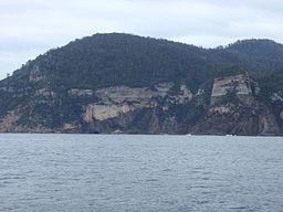
The Forestier Peninsula is a peninsula located in south-east Tasmania, Australia, approximately 60 kilometres (37 mi) by the Arthur Highway, south-east of Hobart. The peninsula is connected to mainland Tasmania at East Bay Neck, near the town of Dunalley at its northern end. At Eaglehawk Neck, the southern end of the Forestier Peninsula is connected to the Tasman Peninsula.
Contents
Map of Forestier Peninsula, Murdunna TAS 7178, Australia
Location and features
The peninsula measures about 20 kilometres (12 mi) long by 15 kilometres (9.3 mi) wide, and is a part of the Tasman municipality. The east coast of the peninsula, facing the Tasman Sea is contained within the Tasman National Park.
Located on Forestier Peninsula facing Norfolk Bay, Flinders Bay, 8 kilometres (5.0 mi) north west of Eaglehawk Neck, was once the site of a convict Probation Station which was established in 1841. The 200 convicts were involved in timber getting and land clearing. The station, beside the mouth of Flinders Creek, was short lived and closed within several years of establishment. The convicts were transferred to the penal settlement of Port Arthur.
The peninsula was severely impacted by the 2013 Tasmanian bushfires with significant property damage, particularly in and around the hamlet of Murdunna.