
Population 313 (2006 census) Postal code 7177 | Postcode(s) 7177 Elevation 5 m Local time Wednesday 10:48 AM | |
 | ||
Location 22 km (14 mi) from Port Arthur40 km (25 mi) from Orford26 km (16 mi) from Sorell53 km (33 mi) from Hobart Weather 18°C, Wind N at 14 km/h, 48% Humidity Points of interest Dunalley Beach, Carlisle Beach, Two Mile Beach, Hyatts Beach | ||
Dunalley is a small fishing village on the east coast of Tasmania, Australia. It is part of the Sorell Council. At the 2006 census, Dunalley had a population of 313.
Map of Dunalley TAS 7177, Australia
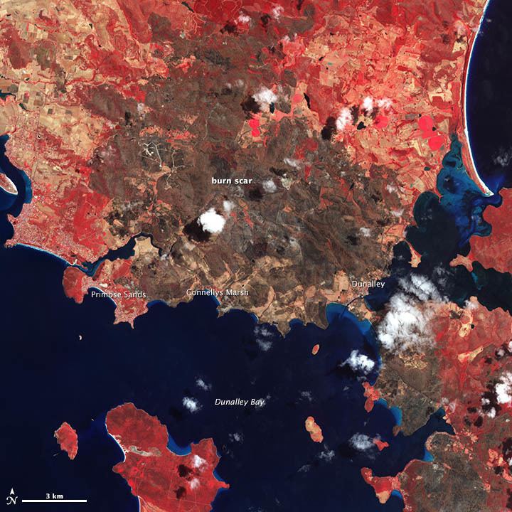
Dunalley is approximately 57 km (35 mi) east of Hobart on the Arthur Highway and 20 minutes from Sorell. It is located on the narrow isthmus which separates the Forestier and Tasman Peninsulas from the rest of Tasmania.
The Denison canal, with a swing bridge for road traffic, has been cut between Dunalley Bay and Blackman Bay to allow boats easy access between the two bays. It was originally hand dug. The project started in 1901 and was completed in 1905. In 1965 a new hydraulic swing bridge replaced the original bridge. It is common for Sydney–Hobart yacht racers returning to Sydney to use the canal as a convenient shortcut.
Dunalley was badly affected by bushfires on 4 January 2013, with the town losing about 65 structures, including the Police Station, school, bakery and local residences.
Dunalley was first named East Bay Neck but was renamed Dunalley after Henry Prittie, 3rd Baron Dunalley (1807-185). Dunalley came from Kilboy in the County of Tipperary, Ireland.