
Prominence 653 m | Elevation 1,441 m | |
 | ||
Isolation 31.1 kilometres (19.3 mi) Similar Storsylen, Storskarven, Fonnfjellet, Ruten, Rensfjellet | ||
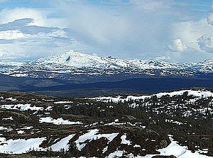
Fongen (Southern Sami: Lopmesvaerie) is a mountain on the border of the municipalities of Selbu (Sør-Trøndelag), Tydal (Sør-Trøndelag), and Meråker (Nord-Trøndelag) in Norway. The 1,441-metre (4,728 ft) summit is located inside Skarvan and Roltdalen National Park, about 15 kilometres (9.3 mi) north of Aunet in Tydal.
Contents
Map of Fongen, 7580 Selbu, Norway
The closest Norwegian Trekking Association cabin is Ramsjøhytta, several kilometers east of the summit.
Name
The name is probably the finite form of fong which means "pole" (used in roundpole fence). It is common in Norway to compare the form of high and steep mountains with staffs, sticks, and poles.
References
Fongen Wikipedia(Text) CC BY-SA