
Lowest elevation 0 m (0 ft) Postal code 840 xx Area 32.22 km² Area code 22860 | Highest elevation 455 m (1,493 ft) Time zone EET (UTC+2) Vehicle registration EM | |
 | ||
Points of interest Agios Nikolaos beach, Paralia Agkali | ||
Discover greece greek islands vol 2 santorini folegandros amorgos ios koufonisia
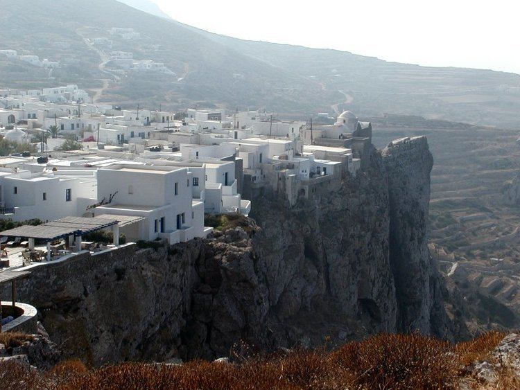
Folegandros (Greek: Φολέγανδρος, also Pholegandros) is a small Greek island in the Aegean Sea which, together with Sikinos, Ios, Anafi and Santorini, forms the southern part of the Cyclades. Its surface area is 32.216 square kilometres (12.439 sq mi) and it has 765 inhabitants. It has three small villages, Chora, Karavostasis, and Ano Meria, which are connected by a paved road. Folegandros is part of the Thira regional unit.
Contents
- Discover greece greek islands vol 2 santorini folegandros amorgos ios koufonisia
- Map of Folegandros Greece
- Greek islands adventure ios sikinos folegandros naxos paros antiparos
- History
- Geography
- References
Map of Folegandros, Greece
Greek islands adventure ios sikinos folegandros naxos paros antiparos
History
Little is known about the ancient history of Folegandros. Its inhabitants were Dorians. Later it came under Athenian rule. The island was conquered in 1207 by the Venetian Marco Sanudo and remained under the rule of Venice until 1566, when it was taken by the Ottoman Turks. The Greeks reclaimed it in the 19th century.
Geography
Folegandros' landscape is varied, and includes tall cliffs and a large cave. The "capital" of the island, Chora, is built on the edge of a 200-metre high cliff. The port of Folegandros is the small village of Karavostasis. The Ano Meria village contains a small but interesting Ecological and Folklore Museum. Among the notable beaches on Folegandros is Katergo, accessible only by boat from Karavostasis. Ketergo beach is used by naturists.