Before World War II, the Italian Royal Air Force Regia Aeronautica constructed a series of airfields in the Foggia area. They consisted of hard-surfaced runways and taxiways, concrete parking areas and permanent buildings for the support units and barracks.
After the Armistice between Italy and Allied armed forces in September, 1943 these airfields were seized by the German Luftwaffe. While under Axis control, the airfields were heavily bombed by the United States Army Air Force and Royal Air Force in 1943 before being seized by the British Eighth Army in October 1943 during the Italian Campaign.
After the area was captured, the facilities were repaired by the United States Army Corps of Engineers (COE) to make them usable for heavy bomber operations by the new Fifteenth Air Force. Weather in southern Italy was much better than in England where the Eighth Air Force was conducting daylight strategic bombing of Occupied Europe and Nazi Germany. Using the Foggia Airfield Complex for strategic bombing missions would allow Allied heavy bombers to attack targets in France, Germany, Austria and the Balkans which were inaccessible from England. In addition to the air forces, Foggia was a major Allied command center for ground forces in southern Italy and naval forces operating in the Adriatic Sea, with numerous headquarters being assigned.
In addition to the captured airfields, several temporary and semi-permanent airfields were constructed for operations by both Twelfth and Fifteenth Air Force units. These airfields, by and large, consisted of grass or Pierced Steel Planking runways and parking and dispersal areas, with support structures were quickly constructed out of wood or tents, along with (if needed) a temporary steel control tower. Six-man tents were used for billeting, lined up in rows with the orderly room and the mess hall at one end. There was one, dimly lit, light bulb at the center of each tent. The tent floor was grass or more commonly, dirt. Eventually plywood was scavenged for flooring, wooden cots were used for beds, and ubiquitous 55-gallon drums were converted into a stoves and other items. As many of these airfields were captured from the Italians and Germans, wrecked enemy aircraft were a common sight, with metal from their fuselages and wings, glass and other useful parts finding their way into the support areas.
By mid-1944, about two dozen airfields were in operation in the Foggia area supporting strategic bombing missions; escort missions; tactical fighter operations, reconnaissance and air defense missions. Albert Speer, Hitler's Minister for Armaments, declared:
I could see omens of the war’s end almost every day in the blue southern sky when, flying provocatively low, the bombers of the American Fifteenth Air Force crossed the Alps from their Italian bases to attack German Industrial targets.
With the end of the war in May 1945, most of the airfields were abandoned and the land returned to the owners, or the Italian government.
Today, most of the airfields are long since returned to agriculture, and little or no evidence remains of their use as wartime airfields. A few, however, still exist as commercial airports and one is still used by the Italian Air Force (Aeronautica Militare).
Airfields and units
The airfield complex consisted of the following major airfields. In addition, there were numerous axillary landing airstrips not listed
Amendola Airfield (now Amendola Air Base (Aeronautica Militare), (ICAO: LIBA))Located approximately 16km northeast of Foggia.
41°32′29.98″N 015°42′44.92″ECaptured Regia Aeronautica airfield used by Fifteenth Air Force, primarily for heavy bombardment units. Repaired by COE in September 1943 and put into use immediately. Last USAAF unit left in March 1946 and airfield turned over to Allied Italian Co-Belligerent Air Force (Aviazione Cobelligerante Italiana, or ACI). Today Italian Air Force (Aeronautica Militare) air base. Extensive remains of wartime use visible in aerial photography.
Bari Airfield (now Bari International Airport (Italian: Aeroporto di Bari) (IATA: BRI, ICAO: LIBD))Located approximately 7km west of Bari.
41°08′19.41″N 016°45′41.24″ECaptured Regia Aeronautica airfield used by Fifteenth Air Force as command and control facility, using airfield for reconnaissance and liaison units. Last USAAF unit left in September 1945 and airfield turned over to Allied Italian Co-Belligerent Air Force (Aviazione Cobelligerante Italiana, or ACI). Military airfield until the late 1960s when opened for civilian airline use. Today evidence of wartime use still visible in older military airfield area.
Canne AirfieldLocated approximately 2.2 miles South-east of Campomarino, mostly now agricultural land, although the taxiway is now the Main Street of Cianaluca village. Airfield named after grass plants still growing round field edges. The houses of Cianaluca have been built on the original hardstand parking bays. The old runway was made of PSP, many pieces of which are now used as garden seats and roofs of small sheds in the vicinity. The old HQ can be seen, as well as possibly Officers mess building, now a two storey building. Runway, taxiway composed of concrete reinforced with large limestone pebbles still showing near the start of old runway. Used by 241 Squadron RAF (Spitfires) December 1943 - May 1944 and afterwards by parts of Italian Anti-cobelligerent Air Force, and Yugoslav Air Force till end of war. Campomarino council has now put up signs for all five of airfields in the immediate area, and has erected memorials to 'All airmen who flew from Biferno, Canne, Madna, Ramitelli, and Nuova airfields during WW2' (Verified June 2016, when researching my fathers death following air test on Spitfire in 1944.)
Castelluccio AirfieldAbandoned, was located approximately 15 km south of Foggia,
41°19′11.69″N 015°32′40.71″ESemi-permanent heavy bomber airfield used by Fifteenth Air Force. Built by COE in early 1944 with one PSP runway with extensive taxiway and hardstand parking areas. Steel control tower. Opened 15 March 1944. Last combat operations flown in late April 1945. Closed August 1945. Today is agricultural area with no structures or any facilities in existence, faint scarring of land shows remains of main runway, taxiways and hardstands visible in aerial photography.
Celone Airfield (Foggia #1)Abandoned German fighter base, was located approximately 1km west-northwest of Foggia,
41°32′26.56″N 015°31′57.57″ESemi-permanent heavy bomber airfield used by Fifteenth Air Force. Built by COE in early 1944 with one 6,000-foot-long PSP runway with extensive taxiway and hardstand parking areas. Steel control tower. Opened 15 February 1944. Last combat operations flown in late April 1945. Closed October 1945. Today is agricultural area with no structures or any facilities in existence, very faint scarring of land shows remains of main runway, taxiways and hardstands visible in aerial photography.
Cerignola AirfieldAbandoned, was located in the vicinity of
Cerignola,
41°15′55.49″N 015°53′40.76″E (Location unknown)Captured Regia Aeronautica airfield used by Twelfth and Fifteenth Air Force as both operational airfield for heavy bombers and tactical fighters. Also major command and control headquarters. Opened late 1943 with combat operations commencing as soon as operationally capable. Last combat operations flown in mid 1944, used by 526th Air Service Group until July 1945 as support base. Closed afterwards. No traces of airfield visible today in aerial photography, suspect land redeveloped in Cerignola suburbs leaving no visible evidence of its existence.
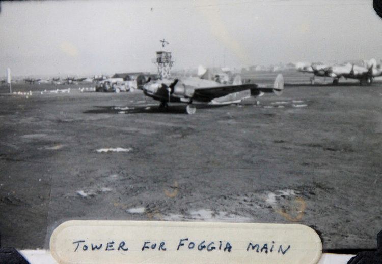
Foggia Airfield (now Foggia-Gino Lisa Airport (Italian: Aeroporto di Foggia) (IATA: FOG, ICAO: LIBF))Located approximately 3km southwest of Foggia.
41°25′55.22″N 015°32′07.82″ECaptured Regia Aeronautica airfield used by Twelfth and Fifteenth Air Force as both operational airfield and as major command and control headquarters. Inactivated February 1946 and turned over to Allied Italian Co-Belligerent Air Force (Aviazione Cobelligerante Italiana, or ACI). Today commercial airport
Giulia AirfieldAbandoned, was located approximately 6km northeast of Cerignola,
41°18′27.36″N 015°56′41.61″ESemi-permanent heavy bomber airfield used by Fifteenth Air Force. Built by COE beginning in late 1943. One PSP runway with extensive taxiway and hardstand parking areas. Steel control tower. Opened January 1944. Supported B-24 Liberator operations, and airfield closed in late July 1945. Today is agricultural area with no structures or any facilities in existence. Almost no evidence of its visibility on aerial photography, however light land scarring of location of main runway is still faintly visible in aerial photography.
Lesina AirfieldAbandoned, was located approximately 22km east-southeast of Campomarino,
41°53′43.20″N 015°17′03.29″ETemporary airfield used by Twelfth and Fifteenth Air Force fighter units. Built by COE in early in 1944 with single main PSP runway, with large parking area for aircraft. Possibly steel control tower, and large containment area for personnel. Supported numerous fighter groups during 1944 and 1945, with last combat operations flown in September 1945 and closed and dismantled soon afterwards. Today is in agricultural area with little or no evidence of its existence. Former main runway now used as agricultural road.
Lucera AirfieldAbandoned, was located approximately 13km west-northwest of Foggia,
41°29′52.72″N 015°25′29.87″ESemi-permanent heavy bomber airfield used by Fifteenth Air Force. Built by COE beginning in late 1943. One PSP runway with extensive taxiway and hardstand parking areas. Steel control tower. Opened early February 1944. Supported B-17 Flying Fortress operations as well as command and control headquarters. Last combat operations flown in late April 1945. Was home of P-51 Mustang equipped 332d Fighter Group "
Tuskegee Airmen" while awaiting return to United States after war ended. Closed October 1945. Today it is an agricultural area with no structures or any facilities in existence, however light evidence of land scarring still is visible in aerial photography.
Madna AirfieldLocated approximately 5,5 km southeast of Campomarino, on the Adriatic coast,
41°58′32.27″N 015°01′12.32″ETemporary airfield used by Twelfth and Fifteenth Air Force fighter groups beginning in November 1943 until end of war. Built by COE with PSP runway (possibly two) with parking area and possible blister hangars. Closed in May 1945 and dismantled. Today is in use as small private airfield, supporting operations of light general aviation aircraft. Remains of wartime runways visible although not in use.
Pantanella AirfieldAbandoned, was located approximately 15km south of Cerignola,
41°08′14.30″N 015°55′12.94″ESemi-permanent heavy bomber airfield used by Fifteenth Air Force. Built by COE in early 1944. Single (possibly double) PSP main runway with extensive taxiway and hardstand parking areas. Steel control tower. Opened March 1944. Very large and expansive facility used by two heavy bomb groups, composed of six operational squadrons. Capacity for approximately 150 heavy bombers with large support facilities with blister hangars as well as wooden structures. Airfield remained in operation until end of war, closing in July 1945. Abandoned and land returned to agricultural use. Faint scarring of land still visible from former airfield use visible on aerial photography, however little or no physical evidence on ground of existence.
Ramitelli AirfieldAbandoned, was located approximately 9 km south-southeast of Campomarino, on the Adriatic coast,
41°56′38.14″N 015°02′53.99″ETemporary airfield used by Fifteenth Air Force 332d Fighter Group, "Tuskegee Airmen". PSP runway with parking area. Built by COE in early 1944. Used by 322d FG until end of war, used by 523d Air Service Group and 949th Air Engineering Squadron after May 1945, closing in October 1945 and airfield dismantled. Today some evidence of main runway visible on aerial photography, land completely returned to agricultural use.
Salsola Airfield (Foggia Satellite #3)Abandoned, was located approximately 17km north of Foggia,
41°36′10.36″N 015°33′53.59″E (Approximate)Temporary airfield used by Fifteenth Air Force 1st Fighter Group, operating P-38 Lightnings. PSP runway with parking area. Built by COE in late 1943. Used by 1st FG until March 1945, closing in April 1945 and airfield dismantled. Today no evidence of existence visible on aerial photography, land completely returned to agricultural use.
San Giovanni AirfieldAbandoned, was located approximately 9km west-southwest of Cerignola,
41°14′21.90″N 015°48′06.57″ESemi-permanent heavy bomber airfield used by Fifteenth Air Force. Built by COE in late 1943. Single (possibly double) PSP main runway with extensive taxiway and hardstand parking areas. Steel control tower. Opened January 1944. Very large and expansive facility used by two heavy bomb groups, composed of six operational squadrons. Capacity for approximately 150 heavy bombers with large support facilities to east of airfield with blister hangars as well as wooden structures. Airfield remained in operation until end of war, closing in October 1945. Abandoned and land returned to agricultural use. Faint scarring of land still visible from former airfield use visible on aerial photography, however little or no physical evidence on ground of existence.
San Severo AirfieldAbandoned, was located approximately 40km north-northwest of Foggia,
41°41′17.78″N 015°22′49.92″E (Location undetermined)Temporary airfield used primarily by Twelfth and Fifteenth Air Force reconnaissance units. Built by COE in late September 1943; last combat operations flown in March 1945. Airfield closed in September 1945. Today is agricultural area with little or no evidence of its existence in aerial photography of area.
Spinazzola AirfieldAbandoned, was located approximately 13km east-southeast of Spinazzola,
40°56′40.00″N 016°13′42.64″ESemi-permanent heavy bomber airfield used by Fifteenth Air Force. Built by COE beginning in September 1943. Single PSP runway with extensive taxiway and hardstand parking areas. Steel control tower. Opened January 1944. Airfield in operation until end of war, closing in August 1945. Abandoned and land returned to agricultural use. Faint scarring of land still visible from former airfield use visible on aerial photography.
Stornara AirfieldAbandoned, was located approximately 14km west of Cerignola,
41°17′24.39″N 015°44′26.22″ESemi-permanent heavy bomber airfield used by Fifteenth Air Force. Built by COE beginning in September 1943. Single PSP runway with extensive taxiway and hardstand parking areas. Steel control tower. Opened January 1944. Airfield in operation until end of war, closing in August 1945. Abandoned and land returned to agricultural use. Faint scarring of land still visible from former airfield use visible on aerial photography.
Torretto AirfieldAbandoned, was located approximately 14km southwest of Cerignola,
41°11′03.23″N 015°46′15.26″ESemi-permanent heavy bomber airfield used by Fifteenth Air Force. Built by COE beginning in September 1943. Two PSP runways with extensive taxiway and hardstand parking areas. Steel control tower. Opened February 1944. Airfield in operation until end of war, closing in August 1945. Abandoned and land returned to agricultural use, Naples-Canosa Autostrada (A16) bisects former airfield. Moderate scarring of land still visible from former airfield use visible on aerial photography.
Triolo AirfieldAbandoned, was located approximately 8km southeast of
San Severo,
41°37′37.85″N 015°26′38.32″E (Approximate)Captured Regia Aeronautica airfield used by Twelfth Air Force fighter units. Repaired by COE in September 1943 and put into use immediately. In operational use until August 1945 when USAAF turned over the facility to Allied Italian Co-Belligerent Air Force (Aviazione Cobelligerante Italiana, or ACI). Dismantled after the war and today is agricultural/light industrial area with antenna farm erected on former airfield site. Possible some former airfield structures and concreted areas still in use by instrial area. Slight scarring of land under former main runway visible in aerial photography.
Venosa AirfieldAbandoned, was located approximately 6km east-northeast of Venosa,
40°59′49.30″N 015°52′37.45″ESemi-permanent heavy bomber airfield used by Fifteenth Air Force. Built by COE beginning in September 1943. One PSP runway with extensive taxiway and hardstand parking areas. Wooden control tower. Opened 14 March 1944. Last combat operations flown in late April 1945. Closed on 4 July 1945. Today is agricultural area with no structures or any facilities in existence, however extensive evidence of land scarring still is visible in aerial photography.
Vincenzo AirfieldAbandoned, was located approximately 9km west-southwest of Barletta,
41°16′54.08″N 016°10′51.08″E (Approximate)Temporary airfield used by Twelfth and Fifteenth Air Force fighter and light/medium bombardment units. Built by COE in late September 1943; last combat operations flown in February 1945; used by 542d Air Service Group until October 1945 when closed. Today is agricultural area with little or no evidence of its existence.