
Barangays ZIP code 3810 Local time Monday 7:02 PM | District Lone District Time zone PST (UTC+8) Area 324.4 km² | |
 | ||
Weather 27°C, Wind W at 0 km/h, 76% Humidity | ||
Flora apayao 2012 nba backstop municipality of flora apayao
Flora, officially the Municipality of Flora (Ilocano: Ili ti Flora; Filipino: Bayan ng Flora), is a municipality in the province of Apayao in the Cordillera Administrative Region (CAR) of the Philippines. The population was 17,391 at the 2015 census. In the 2016 electoral roll, it had 9,490 registered voters.
Contents
- Flora apayao 2012 nba backstop municipality of flora apayao
- Map of Flora Apayao Philippines
- Geography
- Barangays
- Demographics
- References
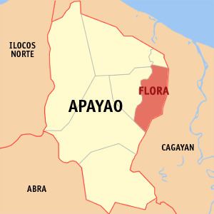
Map of Flora, Apayao, Philippines
Flora was created into a municipality on June 22, 1963 when several barrios and sitios of Pudtol were constituted into the newly created town.
Geography
Flora is located at 18°07′N 121°24′E.
According to the Philippine Statistics Authority, the municipality has a land area of 324.40 square kilometres (125.25 sq mi) constituting 7000735000000000000♠7.35% of the 4,413.35-square-kilometre- (1,704.00 sq mi) total area of Apayao.
Barangays
Flora is politically subdivided into 16 barangays.
Demographics
In the 2015 census, Flora had a population of 17,391. The population density was 54 inhabitants per square kilometre (140/sq mi).
In the 2016 electoral roll, it had 9,490 registered voters.