
River mouth Rhone255 m (837 ft) Length 72 km | Basin size 1,380 km (530 sq mi) | |
 | ||
Main source Manigod1,800 m (5,900 ft) Discharge Average rate:41.2 m/s (1,450 cu ft/s) Similar Alps, Thiou, Gorges du Fier, Lake Annecy, La Tournette | ||
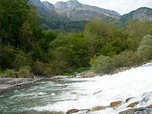
The Fier (French: le Fier) is a 71.9 km (44.7 mi) long river in the Haute-Savoie and Savoie départements, southeastern France. Its source is at Manigod, in the Aravis Range. It flows generally west. It is a left tributary of the Rhone into which it flows at Seyssel.
Contents
Map of Le Fier, France
The Chéran is among its tributaries.
Départements and communes along its courseEdit
This list is ordered from source to mouth:
References
Fier (river) Wikipedia(Text) CC BY-SA