
Country Austria Area code 04245 Elevation 560 m Population 2,290 (1 Apr 2009) | Time zone CET (UTC+1) Website www.ferndorf.gv.at Local time Saturday 1:56 AM Postal code 9702 | |
 | ||
Weather 1°C, Wind SW at 3 km/h, 56% Humidity | ||
Ferndorf (Slovene: Perja vas) is a municipality in the district of Villach-Land in the Austrian state of Carinthia.
Contents
Map of 9702 Ferndorf, Austria
Geography
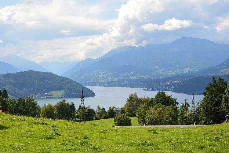
The municipal area stretches from the Drava Valley up to the Mirnock range, part of the Nock Mountains, and the southeastern shore of Millstätter See. It comprises the cadastral communities of Ferndorf and Gschriet, made up of numerous scattered settlements and farmsteads.
Original an agricultural area, the population today largely depends on the magnesite works in nearby Radenthein and on summer tourism. The municipality has access to the Tauern Autobahn (A10) running through the Drava valley and to the parallel railway line from Villach to Spittal an der Drau at Ferndorf station.
History
Vedendorf in the Duchy of Carinthia was first mentioned in a 1391 deed. The present-day parish church of St Paul's is documented since 1438.
The Ferndorf municipality was established after the March Revolution in 1850. From 1865 to 1906 it was incorporated into the neighbouring market town of Paternion.
Politics
Seats in the municipal assembly (Gemeinderat) as of 2015 local elections:
Twin town
Ferndorf is twinned with: