
Elevation 662 m (2,172 ft) | County seat Dage (大阁镇) Area 8,765 km² Area code 0314 | |
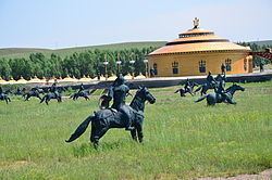 | ||
Country People's Republic of China Township-level divisions 9 towns16 townships1 ethnic township Time zone China StandardChina Standard (UTC+8+8) Points of interest Bashang Grassland, Houding | ||
Fengning Manchu Autonomous County (simplified Chinese: 丰宁满族自治县; traditional Chinese: 豐寧滿族自治縣; pinyin: Fēngníng Mǎnzú Zìzhìxiàn; Manchu: ᡶᡝᠩᠨᡳᠩ ᠮᠠᠨᠵᡠ ᠪᡝᠶᡝ ᡩᠠᠰᠠᠩᡤᠠ ᠰᡳᠶᠠᠨ) is a Manchu autonomous county of northern Hebei province, bordering Beijing to the southwest and Inner Mongolia to the north, and lying under the administration of Chengde City. As of 2004, it had a population of 380,000 residing in an area of 8,765 square kilometres (3,384 sq mi), making it the second-largest county of Hebei in terms of area, after the neighbouring Weichang Manchu and Mongol Autonomous County.
Contents
Map of Fengning, Chengde, Hebei, China
Here, fossil-bearing rocks of the Mesozoic Huajiying Formation and/or Yixian Formation occur on the surface. The prehistoric bird Paraprotopteryx was found in such a deposit.
Administrative divisions
The county has 9 towns, 16 townships, and one ethnic township under its administration.:
Climate
Fengning has a rather dry, monsoon-influenced humid continental climate (Köppen Dwa), with long, very cold and dry winters, and hot, humid summers, and the elevation depresses temperatures. The monthly 24-hour mean temperature in January is −11.2 °C (11.8 °F), and in July it is 22.4 °C (72.3 °F), while the annual mean is 6.83 °C (44.3 °F). More than half of the annual precipitation occurs in July and August alone.
Transport
Both China National Highway 111 and 112 pass through the county, with the former providing direct access to Beijing.