
Location Tasmania, Australia Prominence 600 m Parent range Arthur Range | Elevation 1,224 m Mountain range Arthur Range | |
 | ||
Similar Mount Anne, Frenchmans Cap, Scotts Peak, The Cupola, Mount Geryon | ||
Eastern arthur range and federation peak
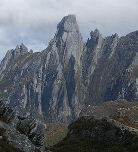
Federation Peak is a prominent mountain (elevation 1,224 metres) located in the Southwest National Park of Tasmania, Australia. The peak, 90 km from Hobart, was named after the Federation of Australia and is often described as one of the hardest Bushwalking challenges in Australia.
Contents
Federation peak
History
The first westerner to notice the peak was the surveyor James Sprent who was carrying out a trignometrical survey of Tasmania and who described it as "the Obelisk". It became known as Sprent's Obelisk, however in 1901 it was officially named Federation Peak in honour of the Federation of Australia which took place that year by Thomas Bather Moore while cutting a track from Hastings to Port Davey via Old River.
The years between its first sighting by Sprent and the first successful summit expedition almost 50 years later saw a mixture of hardy pioneer adventurers trying to bag the peak. The thick horizontal scrub, mixed with ancient cool temperate rainforest which dominates the area proved to be the barrier between men and the mountain. Together with the harsh weather generated by the roaring forties the mountain did not give itself easily. It is a testament to the wildness of the Tasmanian South West that it took almost 50 years to reach its heart and jewel.
After several unsuccessful attempts by various groups in the late 1940s, a party from the Geelong College Exploration Society led by John Béchervaise summited on the 27 January 1949.
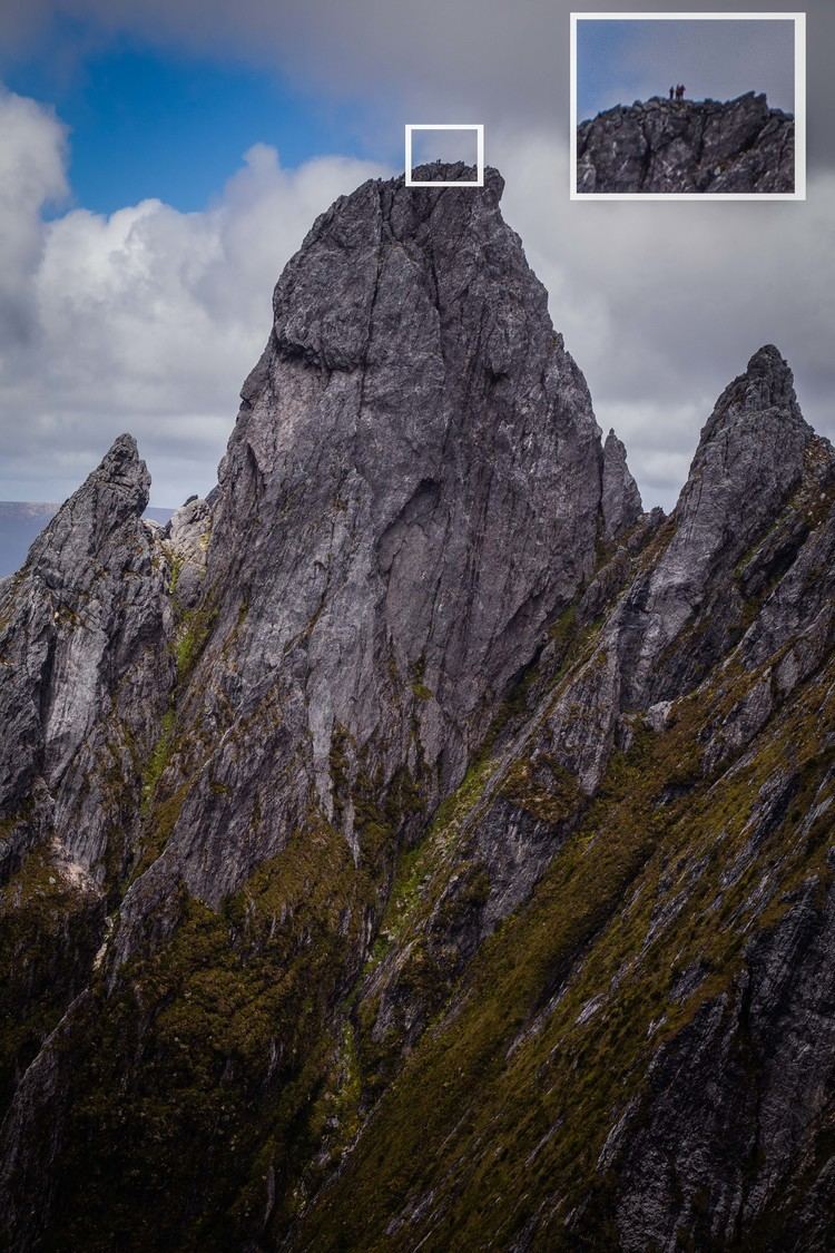
The exposed and technical nature of the usual climbing route that is usually climbed unroped has resulted in a number of fatalities; most recently on 23 March 2016 when a bushwalker fell to her death.
Climate
The highest elevations of the mountain experience alpine conditions with most of the weather patterns determined by the wind. The mountain receives large amounts of snow in autumn, winter and early spring. Unseasonal snowfalls can be seen in summer though many of them don't settle.
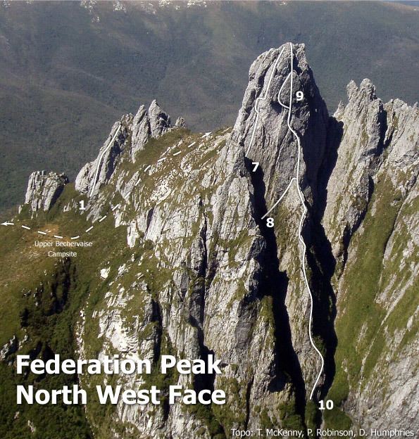
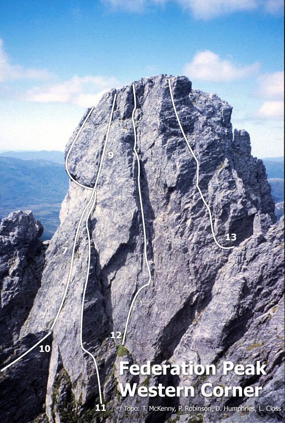
Climbing routes
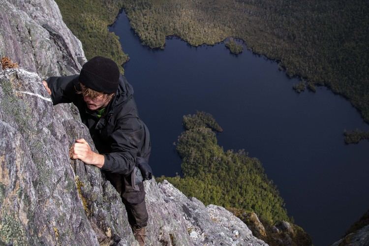
There are a number of graded climbing routes to the summit made by rock climbers, most notably Blade Ridge (grade 18), which is a steep knife edge ridge rising out of the cool temperate forest at the foot of the mountain. The ridge joins the main face of the peak a few hundred metres beneath the summit. The climb from the end of the ridge is then up an exposed but well protected face to the summit, some 600 metres (2,000 ft) above the valley floor.
Most bushwalkers with minimal or no climbing gear take the exposed 'Direct Ascent' scramble from the Southern Traverse of the peak above a drop of 600 m into Lake Geeves.
Access to the base of the peak is generally from Geeveston via Farmhouse Creek and Moss Ridge or Scotts Peak via the Eastern Arthurs. The first route is the shorter of two - generally three days to the peak. The Eastern Arthurs via Scotts Peak Dam takes at least 7 days finishing at Farmhouse Creek; up to 10 days with bad weather.