
Canton Fayence Population (2006) 1,872 Local time Friday 4:19 AM | Department Var Intercommunality Pays de Fayence Area 27.68 km² Number of airports 1 | |
 | ||
Weather 7°C, Wind N at 6 km/h, 76% Humidity | ||
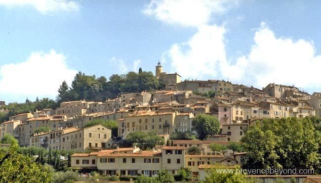
Fayence is a commune in the Var department in the Provence-Alpes-Côte d'Azur region in southeastern France.
Map of 83440 Fayence, France
Fayence is one of a series of "perched villages" overlooking the plain between the southern Alps and the Esterel massif, which borders the sea between Cannes and Saint-Raphaël. The village is located on the road to Mons, which later on joins the Route Napoléon (linking Nice to Grenoble through the Alps).
Some high-standing resorts have settled nearby the village in the recent years: the Domaine de Terre Blanche at Tourrettes, Var and Domaine de Fayence attracting a foreign clientele. The aerodrome of Fayence-Tourettes is one of the most active in Europe for Gliding.
The village contains a primary school (Ecole la Ferrage) and a highschool (Marie Mauron).
Fayence-Tourettes Airport is the biggest glider planes center in Europe, and hosts the Provence Côte d'Azur Aeronautical Association.