
Canton Fayence Time zone CET (UTC+1) Local time Monday 11:13 PM INSEE/Postal code 83138 /83440 | Department Var Area 33.99 km² Area1 33.99 km2 (13.12 sq mi) Population (2006)2 2,597 | |
 | ||
Weather 14°C, Wind NW at 11 km/h, 55% Humidity | ||
Tourrettes is a commune in the Var department in the Provence-Alpes-Côte d'Azur region in southeastern France.
Map of 83440 Tourrettes, France
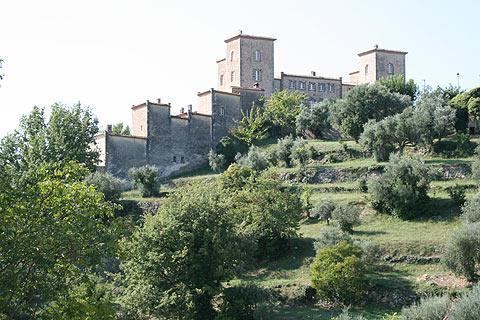
Tourrettes is one of a series of "perched villages" overlooking the plain between the southern Alps and the Esterel massif, which borders the sea between Cannes and Saint-Raphaël. Tourrettes is a charming old Provençal village popular with tourists. The village is located on the road to Mons, which later on joins the Route Napoléon (linking Nice to Grenoble through the Alps).
In the recent years a high-standing golf resort has settled in Tourrettes : the Domaine de Terre Blanche attracting a foreign clientele.
The aerodrome of Fayence-Tourrettes was one of the most active in Europe.
References
Tourrettes, Var Wikipedia(Text) CC BY-SA