
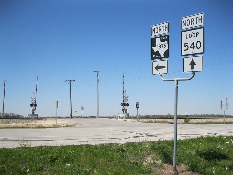
South end: Alt. US 90 at Tavener Counties: Fort Bend Constructed 20 November 1951 | North end: Loop 540 in Beasley Length 7.397 km County Fort Bend County, Texas | |
 | ||
Existed: November 20, 1951 (1951-11-20) – present | ||
Farm to Market Road 1875 (FM 1875) is a state highway in the U.S. state of Texas that stays completely within Fort Bend County. The two-lane highway begins at Texas State Highway Loop 540 (Loop 540) southwest of Beasley and heads generally northwest to U.S. Route 90 Alternate (US 90A) at a location east of Tavener.
Contents
- Map of Farm To Market Rd 1875 Beasley TX 77417 USA
- Route description
- History
- Major intersections
- References
Map of Farm-To-Market Rd 1875, Beasley, TX 77417, USA
Route description
FM 1875 begins at a stop sign on Loop 540 southwest of Beasley. The highway immediately crosses the Union Pacific Railroad tracks and heads straight to the northwest for about 2.75 miles (4.43 km). In this stretch, the road passes Ward Airpark on the right at Kovar Road. At Drachenberg Road, FM 1875 curves briefly to the northeast for 0.25 miles (0.40 km) before swinging back to the northwest again. After heading northwest for 0.65 miles (1.05 km), the highway turns and goes north by northwest for the final 1.0 mile (1.6 km) before ending at a stop sign at US 90A. North of Drachenberg Road, FM 1875 is also known as Beasley Road.
History
FM 1875 was first designated on November 20, 1951, to run about 4.8 miles (7.7 km) from US 90A near Tavener to US 59 near Beasley. On April 14, 1980 a 3.1 miles (5.0 km) section of US 59 near Beasley became Loop 540.
Major intersections
The entire highway is in Fort Bend County.