
 | ||
Similar Upolu, Piula Cave Pool, Falefa Falls, Mount Matavanu, Togitogiga Waterfall | ||
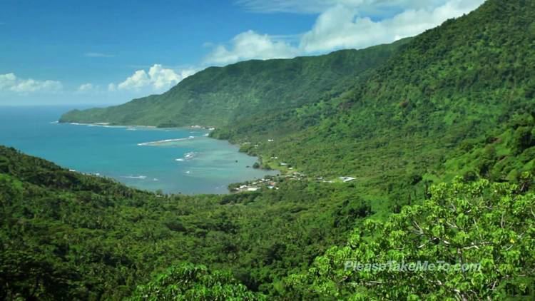
Fagaloa Bay is located on the north eastern coast of Upolu island in Samoa. The area is a significant region of conservation and culture. The bay is situated within the political district of Va'a-o-Fonoti.
Contents
Map of Faga-loa Bay, Samoa
The geographic area consists of a mountain formation rising out of the sea. At the base of the bay lies the village Ta'elefaga at the mouth of the Malata river. To the east above the villages of Lona and Uafato are several waterfalls by mountain forests. On the western side is Mount Fao with spurs dissolving seaward into cliffs called Utuloa. Further east lies Uafato Bay at the eastern base of Malata river which displays spectacular landscape of lush rainforest and waterfalls.
The distinctive features of the Fagaloa area portrays some of the most interesting myths and legends in Samoan mythology which are considered invaluable and relevant to the peoples' cultural lifestyle.
Villages
Situated at Fagaloa Bay are the villages of Sauano, Saletele, Musumusu, Salimu, Ta'elefaga, Maasina, Lona, Samamea and Uafato.
Conservation
The area Fagaloa Bay - Uafato Tiavea Conservation Zone includes native forests and bird life earmarked for Unesco's world heritage protection.