
Native name L'Eyre (f) Length 118 km (73 mi) | Basin size 1,700 km (660 sq mi) | |
 | ||
Main source Sabres, Landes82 m (269 ft) | ||
The Eyre is a coastal river that flows through the Moors of Gascony, in Aquitaine, Southwest France.
Contents
- GeographyEdit
- Dpartements and townsEdit
- TributariesEdit
- Historical anecdoteEdit
- NameEdit
- ActivitiesEdit
- References
The river is generally presented as the confluence of:
Note that Leyre is a variant of the name Eyre, affected by an agglutination of the Romance article.
GeographyEdit
The basin of the Eyre in included in the parc régional des Landes de Gascogne (National Park of the Moors of Gascony).
The river takes form in the Plantiet Marsh, in Grande Lande near Sabres, Landes.
It flows north into the Bassin d'Arcachon, a large bay on the Atlantic coast, in the Pays de Buch, Gironde. Its delta of 30 square kilometres (12 sq mi) contains the Le Teich ornithological park.
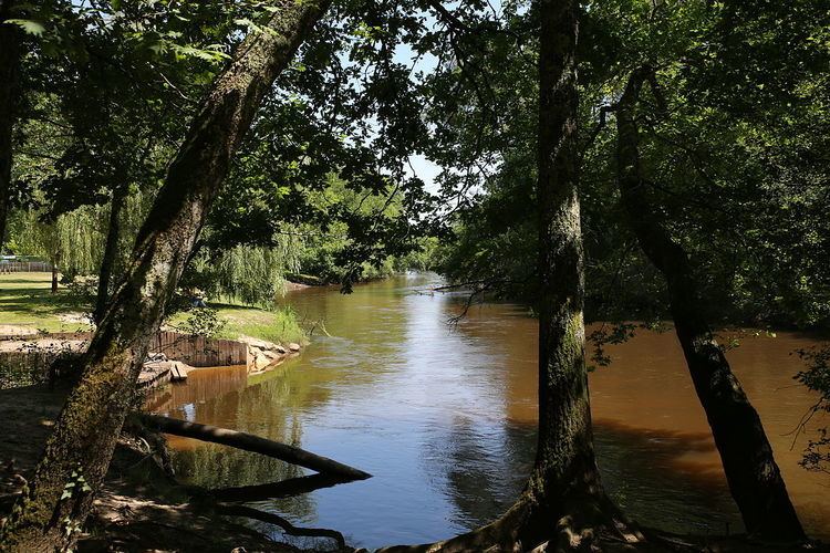
The Eyre flows through a preserved environment. Its banks are bordered by a broad-leaved forest. Branches join over the river, forming a gallery forest, that contrasts with the Landes forest, planted with maritime pines.
Départements and townsEdit
The Eyre flows through the following départements and towns:
TributariesEdit
The main tributary of the Eyre is the Petite-Leyre. It rises between Luxey and Retjons, in Landes, and flows northwest to join the Grande Leyre downstream from Pissos.
N.B. : (R) = right tributary; (L) = left tributary
Historical anecdoteEdit
During the creation of French départements in 1790, it has been suggested to create a large département matching with the natural region of Moors of Gascony, that is the today Landes forest (by the time not yet planted). The name of this département would have been the Eyre.
NameEdit
Eyre is an Aquitanian hydronym. It can be found in names as Eyres-Moncube, Landes, or the craste de l'Eyron (Eyron ditch) in Lacanau, Gironde.