This is a list of the extreme points of Ireland – the points that are farthest north, south, east or west in Ireland. It includes the Republic of Ireland and Northern Ireland.
Often the term "Malin to Mizen" is used when encompassing the entire island from north to south. The geographical centre of Ireland is 8.85 kilometres north-northwest of Athlone Town.
Including islands
Points:
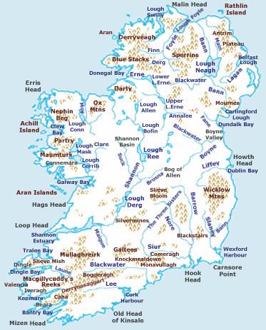
Northernmost point: Tor Beg rock northeast of Inishtrahull, County Donegal, Republic of Ireland (ROI)Southernmost point: Fastnet Rock southeast of Cape Clear Island, County Cork, ROIWesternmost point: Tearaght Island, County Kerry, ROIEasternmost point: Cannon Rock, County Down, Northern Ireland (NI)Settlements:
Northernmost settlement: Ballyhillin, Inishowen Peninsula, County DonegalSouthernmost settlement: Clear Island, County CorkWesternmost settlement: Dunquin, Dingle Peninsula, County KerryEasternmost settlement: Portavogie, Ards Peninsula, County DownMainland only
Points:
Northernmost point: Banba's Crown (the tip of Malin Head), Inishowen Peninsula, County Donegal, Republic of Ireland (Latitude: 55° 23′ 4″ N)Southernmost point: Brow Head (near Mizen Head), County Cork, Republic of Ireland (Latitude: 51° 26′ 52″ N)Westernmost point: Dunmore Head, Dingle Peninsula, County Kerry, Republic of Ireland at V 3014 9804 (Longitude: 10° 28′ 46″ W)Easternmost point: Burr Point, Ards Peninsula, County Down, Northern Ireland (Longitude: 5° 25′ 58″ W)Settlements:
Northernmost settlement: Ballyhillin, Inishowen Peninsula, County Donegal, Republic of IrelandSouthernmost settlement: Crookhaven, County Cork, Republic of IrelandWesternmost settlement: Dunquin, Dingle Peninsula, County Kerry, Republic of IrelandEasternmost settlement: Portavogie, Ards Peninsula, County Down, Northern IrelandHighest point: Carrauntoohil, County Kerry, Republic of Ireland (1,041 m / 3,466 ft)Highest settlement: Meelin, County Cork, Republic of Ireland (254 m / 832 ft)Lowest point: North Slob, County Wexford, Republic of Ireland (-3 m / -10 ft)Many points are on, or near sea level, but due to high rainfall, there are no natural dry pieces of land below sea level - see rivers and loughs below.
Including islands
Northernmost point: Inishtrahull, County DonegalNorthernmost settlement: Ballyhillin, Inishowen Peninsula, County DonegalSouthernmost point: Fastnet Rock, County CorkSouthernmost settlement: Crookhaven, County CorkWesternmost point: Tearaght Island, County KerryWesternmost settlement: Dunquin, Dingle Peninsula, County KerryEasternmost point: Lambay Island, County DublinEasternmost settlement: Wicklow, County WicklowMainland only
Northernmost point: Banba's Crown (the tip of Malin Head), Inishowen Peninsula, County DonegalNorthernmost settlement: Ballyhillin, Inishowen Peninsula, County DonegalSouthernmost point: Brow Head (near Mizen Head), County CorkSouthernmost settlement: Crookhaven, County CorkWesternmost point: Dunmore Head, Dingle Peninsula, County KerryWesternmost settlement: Dunquin, County KerryEasternmost point: Wicklow Head, County WicklowEasternmost settlement: Wicklow, County WicklowHighest point: Carrauntoohil, County KerryLowest point: North Slob, County WexfordHighest settlement: Meelin, County CorkMany points are on, or near sea level, but due to high rainfall, there are no natural dry pieces of land below sea level - see rivers and lochs below.
Including islands
Northernmost point: Rathlin Island, County Antrim at 55°18′N 6°14′WNorthernmost settlement: Rathlin Island, County Antrim at 55°17′N 6°11′WSouthernmost point: Cranfield Point, County Down at 54°1′N 6°3′WSouthernmost settlement: Greencastle, County Down at 54°2′N 6°5′WWesternmost point: Bradoge Bridge, County Fermanagh at 54°27′N 8°10′WWesternmost settlement: Belleek, County Fermanagh at 54°48′N 8°08′WEasternmost point: Canon Rock, County Down at 54°29′N 5°25′WEasternmost settlement: Portavogie, County Down at 54°27′N 5°26′WMainland only
Northernmost point: Benbane Head, County Antrim at 55°15′N 6°28′WNorthernmost settlement: Ballintoy, County Antrim at 55°14′N 6°21′WSouthernmost point: Cranfield Point, County Down at 54°1′N 6°3′WSouthernmost settlement: Greencastle, County Down at 54°2′N 6°5′WWesternmost point: Bradoge Bridge, County Fermanagh at 54°27′N 8°10′WWesternmost settlement: Belleek, County Fermanagh at 54°48′N 8°08′WEasternmost point: Burr Point, Ards Peninsula, County Down at 55°29′N 5°26′WEasternmost settlement: Portavogie, County Down at 54°27′N 5°26′WHighest point: Slieve Donard, County Down (850 m / 2,789 ft)Highest settlement:Greencastle, County Tyrone (188 m / 617 ft)Many points are on, or near sea level, but due to high rainfall, there are no natural dry pieces of land below sea level.