
Airport type Public 13/31 2,800 Address Lindsay, CA 93247, USA Phone +1 559-562-2633 | Owner Mark Daily Elevation AMSL 340 ft / 104 m 2,800 853 Elevation 104 m | |
 | ||
Similar Mefford Field, Eckert Field, Woodlake Airport, Visalia Municipal Airport‑VIS, Porterville Airport‑PTV | ||
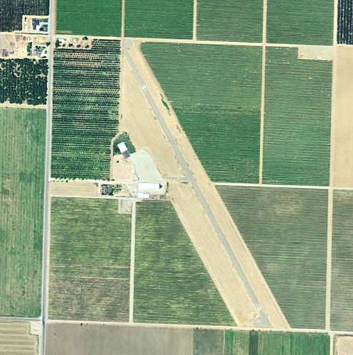
Exeter Airport (FAA LID: O63) is a public use airport located three nautical miles (6 km) south of the central business district of Exeter, a city in Tulare County, California, United States.
Contents
Facilities and aircraft
Exeter Airport covers an area of 26 acres (11 ha) at an elevation of 340 feet (104 m) above mean sea level. It has one runway designated 13/31 with an asphalt/treated surface measuring 2,800 by 40 feet (853 x 12 m). For the 12-month period ending January 9, 2009, the airport had 400 general aviation aircraft operations, an average of 33 per month. At that time there were three single-engine aircraft based at this airport.
History
During World War II, the airport was designated as Hunter Auxiliary Field (A-1). It was used by the United States Army Air Forces as an auxiliary training airfield for the flying school at Rankin Field, California.