
Country United States County Mercer Time zone Eastern (EST) (UTC-5) Zip code 08534 Population 2,587 (2013) | Incorporated January 31, 1890 Elevation 64 m Local time Sunday 5:33 AM | |
 | ||
Area rank 506th of 565 in state11th of 12 in county Weather 5°C, Wind E at 18 km/h, 83% Humidity | ||
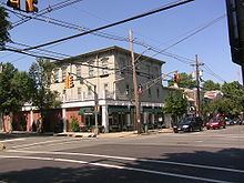
Pennington is a borough in Mercer County, New Jersey, United States. As of the 2010 United States Census, the borough's population was 2,585, reflecting a decline of 111 (-4.1%) from the 2,696 counted in the 2000 Census, which had in turn increased by 159 (+6.3%) from the 2,537 counted in the 1990 Census.
Contents
- Map of Pennington NJ 08534 USA
- History
- Geography
- Census 2010
- Census 2000
- Arts and culture
- Local government
- Federal state and county representation
- Politics
- Education
- Roads and highways
- Public transportation
- Points of interest
- Notable people
- References
Map of Pennington, NJ 08534, USA
History
According to an 1883 history, "the first name of the village was Queenstown, which was given it in honor of Queen Anne. Later it was by some, in derision of its comparative insignificance, Pennytown, and as early as 1747 it began to be called Pennington." The name "Penington" was already known in the area, as Edward Penington (1667-1701), son of the British Quaker leader Isaac Penington, was appointed by his kinsman William Penn as Surveyor General of Pennsylvania. His father-in-law was a longtime leader, including as Governor, of the province of West Jersey, where Edward married. Henry Gannett attributes the borough's name to colonial governors from the Pennington family.
Pennington was established as a borough by an act of the New Jersey Legislature on January 31, 1890, from portions of Hopewell Township, based on the results of a referendum held on January 21, 1890. It is a dry borough, where alcohol cannot be sold.
Geography
According to the United States Census Bureau, the borough had a total area of 0.958 square miles (2.481 km2), including 0.956 square miles (2.476 km2) of land and 0.002 square miles (0.005 km2) of water (0.22%).
The borough is an independent municipality completely surrounded by Hopewell Township, making it part one of 21 pairs of "doughnut towns" in the state, where one municipality entirely surrounds another.
Census 2010
The 2010 United States Census counted 2,585 people, 1,031 households, and 712.4 families residing in the borough. The population density was 2,703.9 per square mile (1,044.0/km2). The borough contained 1,083 housing units at an average density of 1,132.8 per square mile (437.4/km2). The racial makeup of the borough was 95.24% (2,462) White, 1.82% (47) Black or African American, 0.00% (0) Native American, 1.78% (46) Asian, 0.08% (2) Pacific Islander, 0.08% (2) from other races, and 1.01% (26) from two or more races. Hispanics or Latinos of any race were 1.43% (37) of the population.
Out of a total of 1,031 households, 34.9% had children under the age of 18 living with them, 60.4% were married couples living together, 6.6% had a female householder with no husband present, and 30.9% were non-families. 28.4% of all households were made up of individuals, and 19.0% had someone living alone who was 65 years of age or older. The average household size was 2.45 and the average family size was 3.04.
In the borough, 26.4% of the population were under the age of 18, 4.5% from 18 to 24, 17.9% from 25 to 44, 33.4% from 45 to 64, and 17.8% who were 65 years of age or older. The median age was 45.7 years. For every 100 females the census counted 87.7 males, but for 100 females at least 18 years old, it was 79.4 males.
The Census Bureau's 2006-2010 American Community Survey showed that (in 2010 inflation-adjusted dollars) median household income was $107,250 (with a margin of error of +/- $18,509) and the median family income was $156,923 (+/- $18,294). Males had a median income of $106,250 (+/- $20,859) versus $76,477 (+/- $25,432) for females. The per capita income for the borough was $56,962 (+/- $6,372). About 6.2% of families and 6.0% of the population were below the poverty line, including 11.2% of those under age 18 and 2.9% of those age 65 or over.
Census 2000
As of the 2000 United States Census there were 2,696 people, 1,013 households, and 761 families residing in the borough. The population density was 2,801.0 people per square mile (1,084.3/km2). There were 1,040 housing units at an average density of 1,080.5 per square mile (418.3/km2). The racial makeup of the borough was 94.96% White, 2.63% African American, 1.00% Asian, 0.41% from other races, and 1.00% from two or more races. Hispanic or Latino of any race were 1.19% of the population.
There were 1,013 households out of which 40.8% had children under the age of 18 living with them, 66.2% were married couples living together, 7.1% had a female householder with no husband present, and 24.8% were non-families. 22.0% of all households were made up of individuals and 12.4% had someone living alone who was 65 years of age or older. The average household size was 2.66 and the average family size was 3.14.
In the borough the population was spread out with 28.7% under the age of 18, 4.9% from 18 to 24, 23.6% from 25 to 44, 27.9% from 45 to 64, and 15.0% who were 65 years of age or older. The median age was 41 years. For every 100 females there were 92.2 males. For every 100 females age 18 and over, there were 85.0 males.
The median income for a household in the borough was $90,366, and the median income for a family was $107,089. Males had a median income of $84,912 versus $43,068 for females. The per capita income for the borough was $45,843. About 0.7% of families and 2.4% of the population were below the poverty line, including 1.4% of those under age 18 and 4.1% of those age 65 or over.
Arts and culture
Pennington Day, typically in the middle of May, is an annual event where local organizations and businesses set up booths in a street-fair style on Main Street. The event, with origins back to 1980, features local music and a parade early in the day and festivities continuing into the afternoon.
Local government
Pennington is governed under the Borough form of New Jersey municipal government. The governing body consists of a Mayor and a Borough Council comprising six council members, with all positions elected at-large on a partisan basis as part of the November general election. A Mayor is elected directly by the voters to a four-year term of office. The Borough Council consists of six members elected to serve three-year terms on a staggered basis, with two seats coming up for election each year in a three-year cycle. The Borough form of government used by Pennington, the most common system used in the state, is a "weak mayor / strong council" government in which council members act as the legislative body with the mayor presiding at meetings and voting only in the event of a tie. The mayor can veto ordinances subject to an override by a two-thirds majority vote of the council. The mayor makes committee and liaison assignments for council members, and most appointments are made by the mayor with the advice and consent of the council. The Borough Council can appoint an administrator and delegate all or a portion the executive responsibilities to the administrator. The Council may also adopt an administrative code which describes how the Council performs its duties.
As of 2016, the mayor of Pennington is Democrat Anthony J. Persichilli, whose term of office ends December 31, 2019. Members of the Borough Council are Council President Council President Joseph L. Lawver (D, 2018), Catherine "Kit" Chandler (D, 2017), James Davy (D, 2016), Deborah L. Gnatt (D, 2018), Glen E. Griffiths (D, 2017) and Charles Marciante (D, 2016).
Mayor Persichilli was first elected on November 7, 2006, to fill the vacancy left by the resignation of James Loper. Returned to office at that same election were Democratic council members Joseph Lawver and Eileen Heinzel. James Loper, the previous elected mayor, had resigned from office effective February 1, 2006. The Pennington Republican Committee nominated three candidates to take his place and the Council selected James Benton from the three candidates to fill the vacancy. That same procedure was repeated in December 2006, when the Borough Council selected Diane Zompa to fill the unexpired term left by Persichilli.
Federal, state and county representation
Pennington is located in the 12th Congressional District and is part of New Jersey's 15th state legislative district.
New Jersey's Twelfth Congressional District is represented by Bonnie Watson Coleman (D, Ewing Township). New Jersey is represented in the United States Senate by Cory Booker (D, Newark, term ends 2021) and Bob Menendez (D, Paramus, 2019).
For the 2016–2017 session (Senate, General Assembly), the 15th Legislative District of the New Jersey Legislature is represented in the State Senate by Shirley Turner (D, Lawrence Township, Mercer County) and in the General Assembly by Reed Gusciora (D, Trenton) and Elizabeth Maher Muoio (D, Pennington). The Governor of New Jersey is Chris Christie (R, Mendham Township). The Lieutenant Governor of New Jersey is Kim Guadagno (R, Monmouth Beach).
Mercer County is governed by a County Executive who oversees the day-to-day operations of the county and by a seven-member Board of Chosen Freeholders that acts in a legislative capacity, setting policy. All officials are chosen at-large in partisan elections, with the executive serving a four-year term of office while the freeholders serve three-year terms of office on a staggered basis, with either two or three seats up for election each year. As of 2014, the County Executive is Brian M. Hughes (D, term ends December 31, 2015; Princeton). Mercer County's Freeholders are Freeholder Chair Andrew Koontz (D, 2016; Princeton), Freeholder Vice Chair Samuel T. Frisby, Sr. (2015; Trenton), Ann M. Cannon (2015; East Windsor Township), Anthony P. Carabelli (2016; Trenton), John A. Cimino (2014, Hamilton Township), Pasquale "Pat" Colavita, Jr. (2015; Lawrence Township) and Lucylle R. S. Walter (2014; Ewing Township) Mercer County's constitutional officers are County Clerk Paula Sollami-Covello (D, 2015), Sheriff John A. Kemler (D, 2014) and Surrogate Diane Gerofsky (D, 2016).
Politics
As of March 23, 2011, there were a total of 2,017 registered voters in Pennington, of which 828 (41.1%) were registered as Democrats, 467 (23.2%) were registered as Republicans and 720 (35.7%) were registered as Unaffiliated. There were 2 voters registered to other parties.
In the 2012 presidential election, Democrat Barack Obama received 66.0% of the vote (985 cast), ahead of Republican Mitt Romney with 32.7% (488 votes), and other candidates with 1.3% (19 votes), among the 1,653 ballots cast by the borough's 2,115 registered voters (161 ballots were spoiled), for a turnout of 78.2%. In the 2008 presidential election, Democrat Barack Obama received 66.9% of the vote (1,090 cast), ahead of Republican John McCain with 31.0% (506 votes) and other candidates with 1.1% (18 votes), among the 1,630 ballots cast by the borough's 2,088 registered voters, for a turnout of 78.1%. In the 2004 presidential election, Democrat John Kerry received 61.7% of the vote (999 ballots cast), outpolling Republican George W. Bush with 35.9% (581 votes) and other candidates with 0.5% (11 votes), among the 1,619 ballots cast by the borough's 2,022 registered voters, for a turnout percentage of 80.1.
In the 2013 gubernatorial election, Republican Chris Christie received 49.6% of the vote (496 cast), ahead of Democrat Barbara Buono with 48.7% (487 votes), and other candidates with 1.6% (16 votes), among the 1,015 ballots cast by the borough's 2,067 registered voters (16 ballots were spoiled), for a turnout of 49.1%. In the 2009 gubernatorial election, Democrat Jon Corzine received 53.8% of the vote (640 ballots cast), ahead of Republican Chris Christie with 35.7% (425 votes), Independent Chris Daggett with 9.3% (111 votes) and other candidates with 0.3% (3 votes), among the 1,190 ballots cast by the borough's 2,057 registered voters, yielding a 57.9% turnout.
Education
Public school students in kindergarten through twelfth grades attend the Hopewell Valley Regional School District, a comprehensive regional public school district formed in 1965 serving students from Hopewell Borough, Hopewell Township and Pennington Borough.
As of the 2011-12 school year, the district's six schools had an enrollment of 3,797 students and 329.9 classroom teachers (on an FTE basis), for a student–teacher ratio of 11.51:1. Schools in the district (with 2011-12 enrollment data from the National Center for Education Statistics) include four elementary schools — Bear Tavern Elementary School (grades PreK-5; 429 students), Hopewell Elementary School (PreK-5; 474), Stony Brook Elementary School (K-5; 418) and Toll Gate Grammar School (K-5; 300) — Timberlane Middle School with 951 students in grades 6-8 and Hopewell Valley Central High School with an enrollment of 1,225 students in grades 9 - 12.
The Pennington School serves students in sixth through twelfth grades, having been founded in 1838 with a single teacher and three students.
Roads and highways
As of May 2010, the borough had a total of 12.34 miles (19.86 km) of roadways, of which 8.57 miles (13.79 km) were maintained by the municipality, 3.17 miles (5.10 km) by Mercer County and 0.60 miles (0.97 km) by the New Jersey Department of Transportation.
Route 31 passes through Pennington, providing access to Interstate 95 at Exit 4. Additionally, Exit 3B along I-95 connects to Scotch Road North, which provides access to all of the surrounding Hopewell Township area.
Public transportation
NJ Transit provides bus service between the borough and Trenton on the 602 route. The borough is home to a newly designated NJ Transit bus stop at the corner of South Main Street and West Delaware Avenue.
Points of interest
Notable people
People who were born in, residents of, or otherwise closely associated with Pennington include: