
- location below Shaw Hill | - elevation 1,380 m (4,528 ft) - elevation 900 m (2,953 ft) | |
 | ||
- right Tabletop Creek, Hughes Creek, Swamp Creek (New South Wales, Snowy River), Big Tolbar Creek | ||
Dry fly fishing for trout eucumbene river nsw australia
The Eucumbene River, a perennial river of the Snowy River catchment, is located in the Snowy Mountains region of New South Wales, Australia.
Contents
- Dry fly fishing for trout eucumbene river nsw australia
- Map of Eucumbene River New South Wales Australia
- Eucumbene river fly fishing for spawn run trout chuckt s 60th
- Course and features
- References
Map of Eucumbene River, New South Wales, Australia
Eucumbene river fly fishing for spawn run trout chuckt s 60th
Course and features
The Eucumbene River rises below Shaw Hill, in the northern part of the Kosciuszko National Park, approximately 10 kilometres (6.2 mi) north of the village of Kiandra. The river flows generally south and southeast before emptying into Lake Eucumbene where its flow is impounded by Eucumbene Dam. After passing through or over the dam wall, the river flows generally south before emptying into Lake Jindabyne, impounded by Jindabyne Dam. Within Lake Jindabyne, the river reaches its confluence with the Snowy River.
The river descends 476 metres (1,562 ft) over its 84 kilometres (52 mi) course, joined by seven minor tributaries.
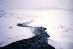
The flow of the river is impacted by alpine conditions; with high flows during spring as a result of snow melt. Meanwhile, during winter, the river is subject to snow and ice conditions.
The Snowy Mountains Highway crosses the river at several locations between Adaminaby and Kiandra.