
 | ||
Esker riada enjoy
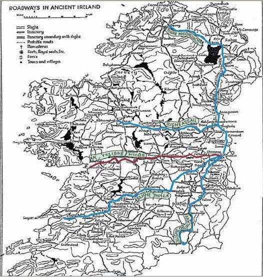
Esker Riada (Irish: Eiscir Riada) is a system of ridges that stretch across the middle of Ireland, between Dublin and Galway.
Contents
Esker riada s races
Geography
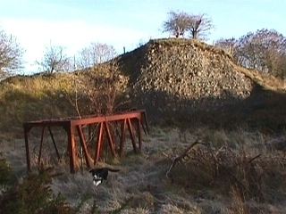
The Esker Riada is a collection of eskers that passes through the counties of Dublin, Meath, Kildare, Westmeath, Offaly, Roscommon and Galway. A large remnant of the Esker exists in the Teernacreeve region of Westmeath, and stretches from Kilbeggan to Tyrrellspass.
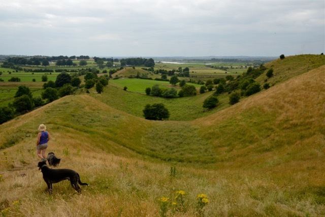
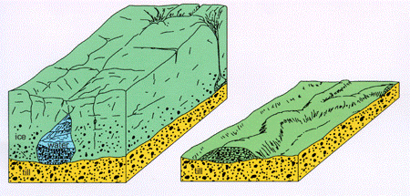
The eskers take the form of relatively low-lying ridges composed of sand, gravel and boulders; deposited by water flowing beneath a glacier; that became exposed when the glacier melted at the end of the last ice age, around 10,000 years ago.
Historical significance
The Irish name 'Eiscir Riada' provides an indication of the significance of the eskers, 'Eiscir' meaning 'divide' and 'Riada' meaning 'road'.
Following a battle at Maynooth, in the year 123 AD, the island of Ireland was divided into two political entities along the line of the eskers – ‘Leath Cuinn’ (‘Conn’s Half’) to the north, and ‘Leath Mogha’ (‘Mogha’s Half’) to the south.
Because the slightly higher ground of the Esker Riada provided a route through the bogs of the Irish midlands it has, since ancient times, formed a highway joining the east and west of Ireland. Indeed, its ancient Gaelic name is ‘An tSlí Mhór’, meaning ‘The Great Way’.
The Great Highway provided a link between Durrow Abbey and the monastic settlement of Clonmacnoise, constructed at the point where the River Shannon passes through the Esker Riada.
In contrast with the surrounding boglands, the glacial sands typical of the eskers provided well drained and relatively good quality land, proving useful in agricultural terms.
Present day
To this day, the Esker Riada continues to serve as a highway, the main N6 Dublin to Galway road still closely following it; and much agricultural activity still takes place along its length. The Dublin part begins at High Street, beside Wood Quay, where the Viking settlement and the original ford made of hurdles, or basketwork, that gives Dublin its name (Átha Cliath) and follows southwest through Kilmainham to Greenhills Road.
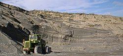
The eskers have become a valued source of building material, with sand and gravel extraction being commonplace. However, the negative environmental impact of such operations is now being realized and this, along with a developing awareness of the ridge’s natural beauty and its significance in Ireland’s history, has led to increasing restrictions. Indeed, Offaly County has moved to give the ridge protection in its County Development Plan, and has gone so far as to press to have the Esker Riada recognized as a World Heritage Site.