Local time Tuesday 10:19 AM | ||
 | ||
Time zone Central Standard Time (UTC-6) Weather 18°C, Wind NW at 3 km/h, 53% Humidity | ||
Erongarícuaro, which means "Place of waiting" in the Purepecha language, is a town in the Mexican state of Michoacán. It is located about an hour and a half drive to Morelia or Uruapan and just 20 minutes from the famous colonial town of Pátzcuaro. The estimated population is about 5,000 people.
Contents
- Map of ErongarC3ADcuaro MichoacC3A1n Mexico
- The town
- Culture
- Entertainment
- Food
- Shopping
- Notable residents of Eronga
- References
Map of Erongar%C3%ADcuaro, Michoac%C3%A1n, Mexico
The town
Erongarícuaro is hidden high in the mountains of Michoacán at 2,200 m (7,130 feet) of elevation. To the east is Lake Pátzcuaro, one of Mexico's highest lakes.
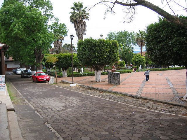
The town retains its ancient atmosphere. It consists of largely one-story adobe or plaster-over-brick buildings with red tile roofs. The streets are dusty cobblestones traveled by horse and car. The plaza has a fountain, stage and amazing collection of trees.
Wandering the streets uphill, there is a cemetery and a chapel.
Culture
Entertainment
Jaripeos, parties and festivals are common throughout the year.
Food
The nieve (ice cream), sold in shops on the plaza, is a delightful treat. There are many different flavors, made with water or cream. Combinations of flavors add variety and taste. One of the most popular flavors is called pasta (paste). Popsicles made from exotic fruits are a pleasant taste adventure.
Except for early evening there is always food on the plaza. Food in the evening would be atole (hot beverage) with buñuelos (light fried pastries) or tamales.
Shopping
Notable residents of Eronga
During Mexico's postwar art scene:
Current artists:
