
Area 3.7 km² | Time zone EET (UTC+2) | |
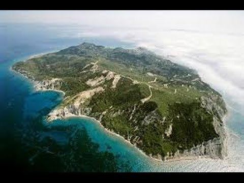 | ||
Ereikoussa (Greek: Ερείκουσσα, Italian: Merlera) is an island and a former community of the Ionian Islands, Greece. It is one of the Diapontia Islands, an island complex to the northwest of Corfu. Since the 2011 local government reform it is part of the municipality of Corfu, of which it is a municipal unit. It is located off the northwestern coast of the island of Corfu, and is almost equidistant from Corfu to the southeast, Mathraki to the southwest, and Othonoi to the west. There is only one town on the island, also named Ereikoússa. Its population was 496 at the 2011 census and its land area is 3.7 square kilometres (1 sq mi). The municipal unit has an area of 4.449 km2. The island is rich in green forests, filled with cypress, and olive trees. It has two beaches, Porto (Πόρτο) and Braghini (Μπραγκίνι); the names are of Italian origin, and date back to the period of Venetian rule. Braghini is rarely visited because it is further away from the main part of the island.
Map of Ereikousa, Erikoussa 491 00, Greece
The two primary ways to get to Ereikoussa are through a boat called Sea Away that leaves from Sidari, a city in northern Corfu, or the Alexandros, a boat that leaves from Corfu Town. The Sea Away takes about 40 min. while the Alexandros takes about 2 hours 45 min.