
Prominence 64 ft (20 m) Range Wasatch Range | Parent range Wasatch Range | |
 | ||
Elevation 5,417 ft (1,651 m) NAVD 88 Location Salt Lake County, Utah, U.S. Topo map USGS Salt Lake City North Easiest route 0.47 mile (0.75 km) hike on Ensign Peak Trail Similar Wasatch Range, City Creek, Utah State Capitol, Farnsworth Peak, Cecret Lake | ||
Hike ensign peak salt lake city ut
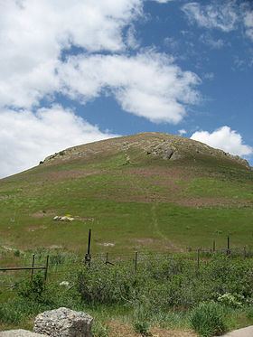
Ensign Peak is a peak in the foothills near downtown Salt Lake City, Utah. It is approximately one mile north of the Utah State Capitol and sits almost directly behind it. On July 26, 1847, Brigham Young and other early members of The Church of Jesus Christ of Latter-day Saints (LDS Church) climbed this hill and gave it its present name. The hill has religious significance in LDS Church history and in its symbolism.
Contents
- Hike ensign peak salt lake city ut
- Map of Ensign Peak Salt Lake City UT 84103 USA
- Ensign peak
- References
Map of Ensign Peak, Salt Lake City, UT 84103, USA
Ensign peak
References
Ensign Peak Wikipedia(Text) CC BY-SA