
Primary inflows Basin countries United States Surface elevation 683 m Water volume 49.99 million m³ | Primary outflows Emigrant Creek Surface area 806 acres (3.26 km) Area 3.262 km² | |
 | ||
Similar Lithia Park, ScienceWorks Museum, Mount Ashland, Schneider Museum of Art, Mount Ashland Ski Area | ||
Emigrant Lake is a reservoir located 5 miles (8 km) southeast of Ashland, Oregon, at the southern end of the Rogue Valley. It has an elevation of 2,241 feet (683 m) above sea level. The lake has an average surface area of 806 acres (3.26 km2), and an average volume of 40,530 acre feet (49,990,000 m3). The lake is impounded by Emigrant Lake Dam, which stands 205 feet (62 m) above the surrounding farmland, and is located on Emigrant Creek at the west side of the lake. The spillway is located at the northern tip of the lake. Emigrant Creek is a tributary of Bear Creek.
Contents
- Map of Emigrant Lake Oregon 97520 USA
- History
- Recreation area
- Drought conditions and archaeological study
- References
Map of Emigrant Lake, Oregon 97520, USA
History
The reservoir was created in 1924 when the original 110-foot (34 m) concrete arch dam was built by the Talent Irrigation District for irrigation and flood control. In 1960, the United States Bureau of Reclamation enlarged the dam into the 204-foot (62 m) rock-filled structure standing today.
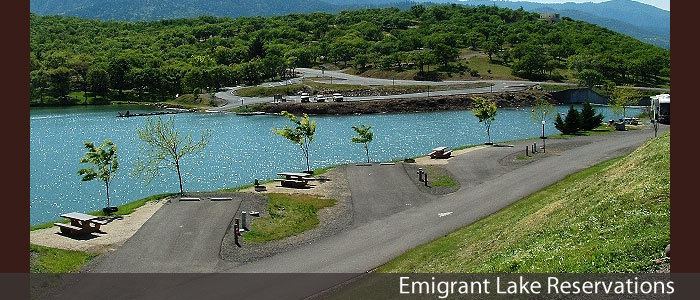
Recreation area
Emigrant Lake features a large recreation area. This includes a 42-site, full-hookup campground, picnic areas, and two 280-foot (85 m) water slides open from Memorial Day to Labor Day.
Drought conditions and archaeological study
In October 2014, drought conditions prompted the Bureau of Reclamation to order an archaeological study to protect artifacts that have become exposed due to the lake being at less than 10 percent of capacity.