
Time zone VUT (UTC+11) Area 32 km² | Highest elevation 644 m (2,113 ft) Elevation 644 m | |
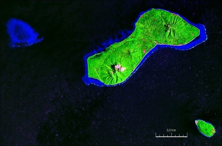 | ||
Emae (coordinates 17°4′S 168°24′E) is an island in the Shepherd Islands, Shefa, Vanuatu.
Contents
Map of Emae, Vanuatu
Maunga Lasi is the highest peak at 644 m. It forms the northern rim of the (mostly) underwater volcano of Makura, which also covers the nearby islands of Makura and Mataso. It is 10 km (6 mi) long and up to 5 km (3 mi) wide, with an area of 32 square kilometres (12 square miles).
Population
The island supports a population of about 750, growing at 3.1% per year. The main settlement is Makata. The principal economic activity is subsistence agriculture. The GDP of the island is $457 per capita. Unlike the surrounding islands populated by Melanesians, Emae and Makura are Polynesian outliers. The island's language, also called Emae, is in the Futunic language family, which includes most of the outliers. North Efate, one of the other languages of the archipelago, is used as a second language. Many of the islanders now live in Port Vila. The crowning of four Emae chiefs in 2004 occurred there, and many of the tribal chiefs live there.
Transportation
The island has an airport, Siwo Airport (IATA: EAE, ICAO: NVSE). The nearby Cook Reef is a popular dive site.