
Airport type Public 9/27 6,500 Code EKI Phone +1 574-264-5217 | Owner City of Elkhart Elevation AMSL 778 ft / 237 m 6,500 1,981 Elevation 237 m | |
 | ||
Address 1211 Co Rd 6, Elkhart, IN 46514, USA Similar Elkhart County Superior, Ideal Beach, Superior Court No 5, Osolo Twp Fire Departme, Superior Court Vi Bailiff | ||
Elkhart municipal airport butler fairman seufert
Elkhart Municipal Airport (IATA: EKI, ICAO: KEKM, FAA LID: EKM) is a city-owned public-use airport located three nautical miles (6 km) northwest of the central business district of Elkhart, a city in Elkhart County, Indiana, United States.
Contents
- Elkhart municipal airport butler fairman seufert
- The june 2015 elkhart municipal airport sale
- Facilities and aircraft
- Former airlines and destinations
- References
Although most U.S. airports use the same three-letter location identifier for the FAA and IATA, Elkhart Municipal Airport is assigned EKM by the FAA and EKI by the IATA. The airport's ICAO identifier is KEKM.
The june 2015 elkhart municipal airport sale
Facilities and aircraft
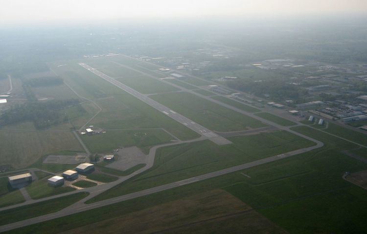
Elkhart Municipal Airport covers an area of 640 acres (260 ha) at an elevation of 778 feet (237 m) above mean sea level. It has two asphalt paved runways: 9/27 is 6,500 by 120 feet (1,981 x 37 m) and 18/36 is 4,001 by 75 feet (1,220 x 23 m). It also has one turf runway designated 8/26 which measures 2,500 by 100 feet (762 x 30 m).
For the 12-month period ending December 31, 2005, the airport had 33,211 aircraft operations, an average of 90 per day: 96% general aviation, 3% air taxi and 1% military. At that time there were 73 aircraft based at this airport: 62% single-engine, 23% multi-engine, 8% jet, 4% helicopter and 3% military.