
State Tasmania MP Tania Rattray Founded 1999 Elector 23,424 | Created 1999 Electors 23,424 (January 2015) Member of parliament Tania Rattray Party Independent politician | |
 | ||
Namesake Apsley River (Lord Apsley) Area 19,204 km (7,414.7 sq mi) | ||
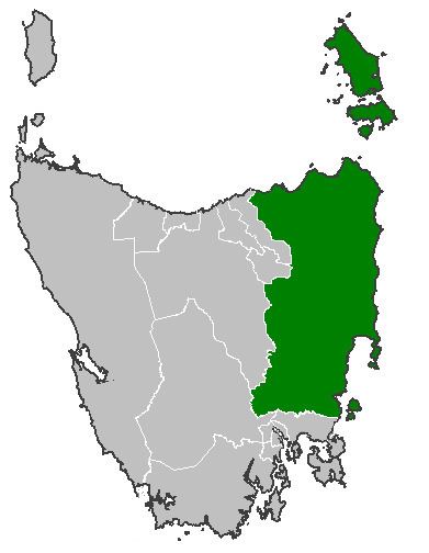
The Electoral division of Apsley is one of the 15 electorates or seats in the Tasmanian Legislative Council. It is the second-largest upper house electorate in the state by area after Murchison.
The total area of the Apsley division is 19,204 square kilometres (7,415 sq mi). The electorate created in 1999 is named after the Apsley River and the Douglas-Apsley National Park. These were named by William Lyne in honour of Lord Apsley, earl of Bathurst.
As of 31 January 2015, there were 23,424 enrolled voters in Apsley. The current member in the legislative council is Tania Rattray who was elected in 2004 and re-elected unopposed in 2010. Members serve six-year terms, before facing re-election: the next election in Apsley is due in 2016.
Towns within the division include: Pipers River, Scottsdale, Evandale, Swansea, Derby, Lilydale, Bridport, Campbell Town, Colebrook, St Helens, Branxholm, Avoca, Fingal, Bicheno, Bagdad, Bellingham, Tomahawk, Ross, St Marys, Rossarden and many others.