
Time zone EAT (UTC+3) Local time Wednesday 12:47 PM | Climate Cfb | |
 | ||
Weather 26°C, Wind NE at 24 km/h, 25% Humidity | ||
Alcoblow device took its course along nakuru eldama ravine road
Eldama Ravine is a town in Baringo County, Kenya, a few miles north of the equator,geographical coordinates 0° 30' 0" North, 35° 43' 0" East. It was established as an administrative point by British colonialists and later served as a transit route for lumber harvested from surrounding forests.
Contents
- Alcoblow device took its course along nakuru eldama ravine road
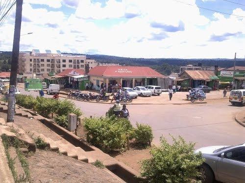
- Map of Eldama Ravine Kenya
- Chemususu half marathon held in eldama ravine baringo county
- Naming
- References
Map of Eldama Ravine, Kenya
It was previously the headquarters of the former Koibatek District and Eldama Ravine Constituency.
It has a population of 18,231. It is largely an agricultural trade point producing world popular commercial rose flowers. It is fairly cosmopolitan home to more than half of Kenya's ethnic tribes.
Chemususu half marathon held in eldama ravine baringo county
Naming
The Eldama Ravine was first known as Shimoni due to the presence of a narrow ravine through which the Eldama Ravine River flows. Eldama, the non-English part of the name, is derived from the Maasai word ‘eldama’, which means narrow gorge.
The town was established by Nubians who worked as soldiers and transporters for the British IBEA in 1887. It became the headquarters of the Naivasha province, then under the Uganda Protectorate.