
Demonym(s) Portuense Population 88,700 (2014) | Elevation 0 m (0 ft) Time zone CET (GMT +1) | |
 | ||
Weather 14°C, Wind N at 14 km/h, 83% Humidity Points of interest Aqualand Bahía de Cádiz, Playa de Valdelagrana, Castle of San Marcos, Plaza de toros de El Puerto, Priory Church - El Puerto de | ||
El puerto de santa mar a villa marinera c diz
El Puerto de Santa María (Spanish: "The Port of Saint Mary", locally known as just El Puerto) is a municipality located on the banks of the Guadalete River in the province of Cádiz, Andalusia. As of 2016, the city has a population of c. 88,184, of which some 50,000 live in the urban center, and the remainder in the surrounding areas.
Contents
- El puerto de santa mar a villa marinera c diz
- Map of El Puerto de Santa MarC3ADa 11500 CC3A1diz Spain
- Video turismo el puerto de santa mar a
- History
- Geography
- Economy
- Culture
- Main sights
- Events
- Twin towns Sister cities
- Famous people
- References
Map of El Puerto de Santa Mar%C3%ADa, 11500, C%C3%A1diz, Spain
The town of El Puerto de Santa María is 10 kilometres (6 miles) north east of Cádiz across the bay of Cádiz and is best known for having been the port from which Columbus sailed on his second voyage to the Americas.
Video turismo el puerto de santa mar a
History
According to the legend told in the Odyssey of Homer, after the Trojan War a Greek official named Menestheus escaped with his troops through the Straits of Gibraltar and reached the Guadalete River. They established themselves here and called that port Menestheus's port.
In 711, Arab (Moors) from the North of Africa invaded southern Spain. They renamed the place Alcante or Alcanatif which means Port of Salt, due to the old salt industry of Phoenicians and Romans.
In 1260, Alfonso X of Castile conquered the city from the Moors and renamed it Santa María del Puerto. He organized the land distribution and conceded a charter under the Crown of Castile. Having received a royal charter the city was then allowed to use the title "El" prior to the name of the city itself. This is a distinguishing property and even though Madrid is the capital of Spain it has not earned this distinction. In his Cantigas de Santa Maria CSM 367, Alfonso sings that he was miraculously healed of swollen legs after visiting his church of Santa Maríado Porto.
Christopher Columbus's second expedition to the Americas set sail from El Puerto de Santa María. His pilot, Juan de la Cosa drew his world map (the first including the coast of New World) in El Puerto in 1500.
Columbus visited El Puerto in 1480 and received encouragement for his travel plans. He also met Juan de la Cosa who issued the first world map in 1500.
El Puerto was the residence of several wealthy cargadores, merchants who operated Spain's trade with the Americas.
During the 16th and 17th centuries, it was the winter port of the royal galleys.
In the nineteenth century the city became the General Headquarters for the French Army during the Peninsular War under the reign of Joseph Bonaparte (1801–1812).
The town is steeped in history, museums and monuments. It is also within easy reach of the historical cities of Seville and Cádiz.
Geography
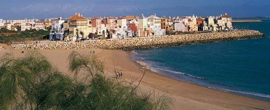
El Puerto de Santa María is located on the Atlantic coast of the Bay of Cádiz, near the municipalities of Jerez de la Frontera, Rota, Puerto Real, and Cádiz. It is popular for its sherry and for its beaches, which are the town's principal tourist attraction. Well known beaches include Vistahermosa, Valdelagrana, and La Puntilla. Like many other southern cities, there are many smaller towns encompassed by the municipality. There is also a major port, known as Puerto Sherry. A large amount of land has been devoted to the Bay of Cádiz Nature Reserve.
Economy
The most important economic activity is tourism, mainly because of the beaches, as well as the bullfights held at the arena during the summer. The town also hosts large groups of motorcyclists during the Jerez Motorcycle Grand Prix. There is commercial development in the center and periphery, and a highly developed wine industry.
Culture
Listed are a few of the main fiestas in the area:
Main sights
El Puerto de Santa María is situated in the middle of the Parque natural Bahia de Cádiz. This include two square kilometres (1.2 mi) of pine forest which form one part of the three ecosystems in the area. An endangered species of chameleon along with other reptiles and birds of immense variety can be found in the forest. Egyptian mongoose can also be spotted in the area. The area boasts two other Natural parks, the Sierra de Grazalema and El Coto Donaña.
Events
Bullfighting is still enjoyed during the Feria season during the month of August, and during the Feria de la Primavera (Spring Fair) in early May. This Feria is dedicated to sherry wine and 180,000 half bottles are drunk in 4 days. There are several bodegas (wineries) in the town centre, all of which can be visited by the public. The most famous bodegas in El Puerto are Osborne and Terry both of which export sherry and brandy worldwide. In the cellars of El Puerto, the dry, pale sherry known as Fino is produced using the traditional method called solera. This method produces Fino, the sweet Muscatel, Amontillado and the older Oloroso.
Twin towns – Sister cities
El Puerto de Santa María is twinned with: