
Local time Tuesday 10:50 AM | ||
 | ||
Weather 12°C, Wind S at 16 km/h, 80% Humidity | ||
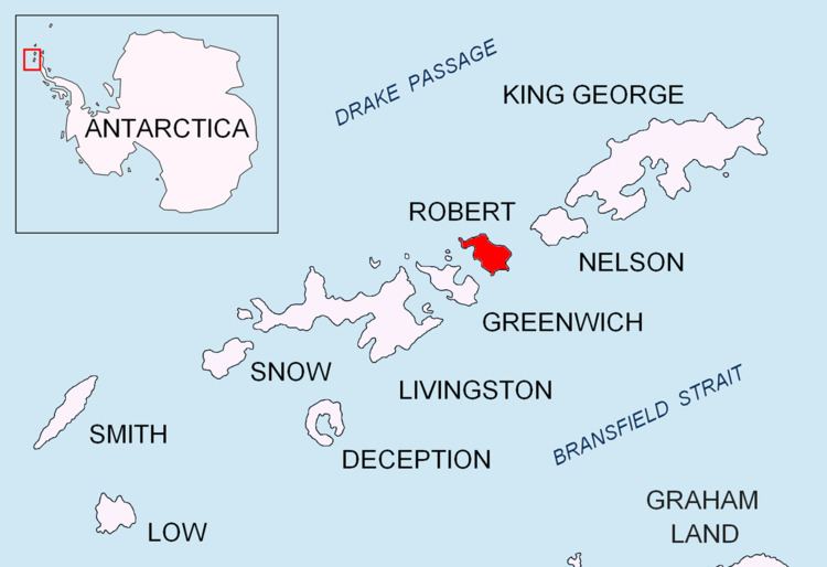
Edwards Point is a rocky point in the south extremity of Kermen Peninsula and Robert Island in the South Shetland Islands, Antarctica. The point is a southeast entrance point of English Strait and forms the west side of the entrance to Devesil Bight and the southeast side of the entrance to Micalvi Cove. The area was visited by early 19th century sealers.
Contents
Map of Edwards Point, Tennessee 37377, USA
The feature is named after Victor Edwards, a draughtsman in the British Admiralty Hydrographic Office during the 1930s.
Location
The point is located at 62°27′46″S 59°29′57″W which is 5.04 km northeast of Santa Cruz Point, Greenwich Island, 4.57 km southeast of Beron Point, and 6.14 km west-southwest of Robert Point (British mapping in 1935 and 1968, and Bulgarian in 2005 and 2009).
Maps
References
Edwards Point Wikipedia(Text) CC BY-SA