
Founded 1837 Area 1,500 km² | Website www.eatoncounty.org Population 108,348 (2013) | |
 | ||
Destinations Points of interest Grand Woods, Funtyme Adventure Parks, Lincoln Brick Park, Springz, Jaycee Park | ||
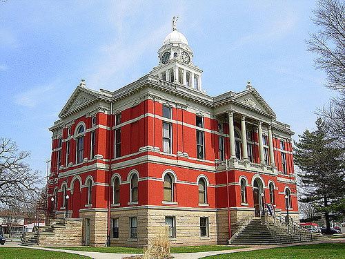
Eaton County is a county in the U.S. state of Michigan. As of the 2010 census, the population was 107,759. The county seat is Charlotte. The county was organized in 1837 and named for John Eaton, who was Secretary of War under U.S. President Andrew Jackson, making it one of Michigan's Cabinet counties.
Contents
- Map of Eaton County MI USA
- History
- Geography
- Rivers
- Adjacent counties
- Airports
- Demographics
- Government
- Elected officials
- County Board of Commissioners
- Education
- Cities
- Villages
- Census designated place
- References
Map of Eaton County, MI, USA
Eaton County is included in the Lansing-East Lansing, Metropolitan Statistical area in Central Michigan.
History
Eaton County was formed in 1837 from open territory. It was named after John H. Eaton, an American Secretary of War. The county is one of the so-called Cabinet counties because it was named after a member of the cabinet of US President Andrew Jackson.
The county of Eaton was created by an act of the legislative council of the territory of Michigan, passed October 29, 1829, which reads as follows: "That as much of the country as is included within the following limits, viz., north of the base line and south of the line between townships four and five north of the base line, and east of the line between ranges six and seven west of the meridian, and west of the line between ranges two and three west of the meridian, be and the same is set off into a separate county, and the name thereof shall be Eaton." The county was named in honor of Gen. John H. Eaton, secretary of war in the cabinet of President Andrew Jackson.
On November 4, 1829, the territorial council of Michigan enacted, "That the county of Eaton shall be attached to and compose a part of the county of St. Joseph." The next day, November 5, 1829, the same council passed a law that the counties of Eaton, Branch and Calhoun, and all the country north attached to Eaton be set off into a township by the name of Eaton, and it was ordered that the first town meeting should be held at the house of Jabez Bronson, who lived on the site of the present village of Bronson in Branch county. This was no hardship, for there was not at that time a single white settler within the bounds of Eaton county.
On July 30, 1830, the territorial council attached Eaton to Kalamazoo county for judicial purposes. This attachment lasted for nearly five years, but on March 17, 1835, the territorial council enacted: "That the county of Eaton shall be a township of Belleville,' and the first township meeting shall be held at such place as the sheriff of Calhoun county shall appoint in said county of Eaton, and shall be attached to the county of Eaton for all judicial purposes."
The final act which gave Eaton county an independent existence was passed by the state legislature, December 29, 1837. It provided "that the county of Eaton be and the same is hereby organized, and the inhabitants thereof entitled to all the rights and privileges to which by law the inhabitants of other counties of this state are entitled." While the name "Belleville" was given to the first organized township, including the whole county, it does not appear to have been used in any official documents. The second place where the name of the township is mentioned in a legislative enactment is in the session laws of 1837, March 17, where it appears under the name of "Bellevue." Official business has always been transacted under the latter name, and yet there is no known law showing that the name has ever been legally changed from "Belleville." The first division of the town of Bellevue occurred March 11, 1837, when Eaton and Vermontville were organized. The four northwestern townships, now Vermontville, Chester, Roxand and Sunfield, were set off as a township and named Vermontville; while the four southeastern townships, now Eaton, Eaton Rapids, Hamlin, and Brookfield were organized as the township of Eaton.
This left the four northeastern towns, Benton, Oneida, Delta, and Windsor, and the four remaining towns, Bellevue, Kalamo, Carmel, and Walton, cornering at the geographical center of the county in a single organized township known as Bellevue. But on March 6, 1838, the northeast quarter of the county was detached from Bellevue and formed the town of Oneida. As early as 1832, George W. Barnes, a surveyor, found the beautiful prairie near the center of Eaton county, on which the city of Charlotte is located, and bought the land of the government; and on March 21, 1833, before the county contained a single white settler, he made application to Governor George B. Porter for the appointment of commissioners to locate the seat of justice, making affidavit, "that in the month of may last he put up in three public places in the county of Kalamazoo notices that application would be made to the governor of the territory of Michigan to appoint commissioners to locate a seat of justice for Eaton County, agreeably to the law in such cases made and provided."
On April 29, 1833, Charles C. Hascall, Stillman Blanchard, and John W. Strong were appointed such commissioners. On June 5, of the same year, they reported to Governor Porter that they met "at Prairie Round (Ronde) in the county of Kalamazoo on the 27th day of may, 1833, and on June 4, located the county seat on land which is owned by George W. Barnes;" and they added, "the point selected for the seat of justice in this county is on a beautiful prairie, about one mile square, near two and a half miles south of the center of the county, and about one mile north of the Battle creek, the nearest point to the center of the county where water can be obtained for hydraulic purposes.
Geography
According to the U.S. Census Bureau, the county has a total area of 579 square miles (1,500 km2), of which 575 square miles (1,490 km2) is land and 4.3 square miles (11 km2) (0.7%) is water.
Rivers
Adjacent counties
Airports
Demographics
As of the 2010 United States Census, there were 107,759 people residing in the county. 87.8% were White, 6.3% Black or African American, 1.7% Asian, 0.4% Native American, 1.2% of some other race and 2.6% of two or more races. 4.7% were Hispanic or Latino (of any race). 24.2% were of English ancestry, 22.9% were of German ancestry and 9.3% were of Irish ancestry.
As of the census of 2000, there were 103,655 people, 40,167 households, and 28,237 families residing in the county. The population density was 180 people per square mile (69/km²). There were 42,118 housing units at an average density of 73 per square mile (28/km²). The racial makeup of the county was 90.25% White, 5.29% Black or African American, 0.44% Native American, 1.13% Asian, 0.03% Pacific Islander, 1.17% from other races, and 1.70% from two or more races. 3.21% of the population were Hispanic or Latino of any race. 95.6% spoke only English, while 2.0% spoke Spanish.
There were 40,167 households out of which 33.80% had children under the age of 18 living with them, 56.30% were married couples living together, 10.30% had a female householder with no husband present, and 29.70% were non-families. 24.50% of all households were made up of individuals and 8.40% had someone living alone who was 65 years of age or older. The average household size was 2.54 and the average family size was 3.03.
In the county, the population was spread out with 26.10% under the age of 18, 9.10% from 18 to 24, 28.80% from 25 to 44, 24.60% from 45 to 64, and 11.30% who were 65 years of age or older. The median age was 36 years. For every 100 females there were 94.60 males. For every 100 females age 18 and over, there were 91.50 males.
The median income for a household in the county was $49,588, and the median income for a family was $57,898. Males had a median income of $41,978 versus $29,638 for females. The per capita income for the county was $22,411. About 4.10% of families and 5.80% of the population were below the poverty line, including 6.80% of those under age 18 and 5.90% of those age 65 or over.
Government
The county government operates the jail, maintains rural roads, operates the major local courts, keeps files of deeds and mortgages, maintains vital records, administers public health regulations, and participates with the state in the provision of welfare and other social services. The county board of commissioners controls the budget but has only limited authority to make laws or ordinances. In Michigan, most local government functions — police and fire, building and zoning, tax assessment, street maintenance, etc. — are the responsibility of individual cities and townships.
Elected officials
County Board of Commissioners
15 members, elected from districts (9 Republicans, 6 Democrats)
Education
School districts located in Eaton County:
NOTE