
Country United States Time zone PST (UTC-8) Elevation 191 m Population 55,191 (2013) | State California Incorporated October 1, 2010 ZIP codes 92880 and 91752 Local time Friday 7:01 AM | |
 | ||
Weather 12°C, Wind NE at 2 km/h, 75% Humidity Area codes Area code 909, Area code 951 | ||
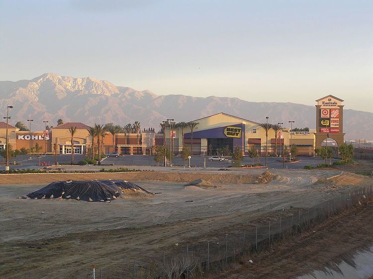
Eastvale is a city located in northwestern Riverside County, California, the Inland Empire region of Southern California. Its boundaries extend from Hellman Avenue to the West (the San Bernardino County Line), Bellgrave Avenue to the North (also the San Bernardino County Line), the Santa Ana River and Norco to the South, and Interstate 15 to the East. The population was 53,668 at the 2010 census.
Contents
- Map of Eastvale CA USA
- Geography
- Climate
- Before 1954
- Recent history
- Incorporation effort
- Demographics
- Law and government
- Community
- Education
- References
Map of Eastvale, CA, USA
Geography
Prior to incorporation, street addresses were addressed as "Corona, California" since the post office in that city was the closest one that could handle the volume from the new construction in the area.
The Los Angeles County line is approximately 8 miles northwest of Eastvale, while the Orange County line is approximately 5 miles to the southwest. The proximity of these last two heavily commercialized counties, and the fact that Eastvale is roughly squared between Interstate 15 and California State Routes 91, 60, and 71, has made Eastvale popular for those that commute to these counties for employment, making Eastvale a commuter town.
According to the Eastvale area plan, Eastvale has a total area of 13.1 square miles (33.9 km²), of which 12.5 square miles (32.3 km²) is land and 0.6 square miles (1.6 km²), or 4.76%, is water.
According to the United States Census Bureau, the former census-designated place of Eastvale covered an area of 11.4 square miles (29.6 km²), 99.65% of it land, and 0.35% of it water.
Eastvale has two postal ZIP codes—92880 and 91752, with current mailing addresses of Corona and Mira Loma.
Most of Eastvale, like most of western Riverside County, has the telephone area code of 951. However, according to the California Public Utilities Commission, because the 951 area code was split along telephone service areas and not strictly along county boundaries, some Eastvale residents still retain the older 909 area code.
Climate
Eastvale experiences a warm Mediterranean climate (Köppen climate classification CSa) and has mild winters and hot summers. Most of the rainfall (as in all of Southern California) occurs during winter and early spring. The winter low temperatures can get cold enough for frost. Winter days are pleasant, with the mercury staying around 65 degrees Fahrenheit (occasionally warming into the 70s). Summertime is hot, with highs averaging in the low 90s. During the hottest months, daytime temperatures in Eastvale often exceed 100 degrees.
Before 1954
The Eastvale region was part of the homeland of the indigenous Tongva people for ~8,000 years
Recorded history of land in the far western side of present-day Riverside County and north of the Santa Ana River begins in 1838, when Mexican Governor Juan Alvarado, of the Alta California territory, granted Rancho Jurupa (some 48 square miles) to Juan Bandini. The city of Eastvale now occupies approximately the westernmost one-quarter of former Rancho Jurupa land grant. The Mexican-American War between the United States and Mexico ended in 1848 with the Treaty of Guadalupe Hidalgo, by which Mexico ceded Alta California and much other Southwestern land to the US. Two years later, on 9 September 1850, California became a U.S. state.
For 65 years, between 1889 and 1954, the Fuller family owned about 6 square miles of ranch land on the north side of the Santa Ana River. Almost half of present-day Eastvale, between Schleisman Road and the river, was included within the Fuller ranch’s boundaries.
Eastvale, often spelled with two words as "East Vale" in early days, was an elementary school district in Riverside County for more than 50 years, from County formation in 1893 until 1947 when the district was merged with Corona and Norco schools.
Recent history
Eastvale, once a rural area, was predominantly dairy farms and agricultural until the late 1990s. At that time, the area started to suburbanize to accommodate the influx of people coming from neighboring Orange and Los Angeles Counties seeking affordable housing. Eastvale was particularly hit hard by the United States housing bubble that burst in the late 2000s. A large portion of the communities' homes were sold during the early and mid-2000s at highly inflated prices fueled by the subprime mortgage industry. In June 2006, the median home in Eastvale was valued at $601,000 and had drastically fallen to $304,000 by June 2009 according to Zillow, representing a 50% decrease in home values over a span of three years.
Incorporation effort
Eastvale was one of several unincorporated areas of Riverside County that had strong community support for city incorporation. The passage of AB 1602 in the mid-2000s, a state bill that adds funds from vehicle license fees, made it easier for unincorporated areas to attain cityhood. In 2008, the communities of Menifee, Sun City and Quail Valley merged and incorporated as the City of Menifee. The law also stirred up renewed interest in incorporation efforts for Mira Loma and Jurupa Valley (Mira Loma, Pedley, Glen Avon, Sunnyslope, and Rubidoux).
The community of Eastvale actively attempted to incorporate from the mid-2000s through 2010. The incorporation effort was being led by the Eastvale Incorporation Committee. Other groups are also proponents of Eastvale cityhood, such as the Yes on Eastvale Cityhood Committee.
The incorporation effort was opposed by the Not NOW Eastvale group that was co-chaired by one of the 18 City Council candidates as well as other groups. These groups feared that the city had not developed a strong enough tax base to sustain itself as a city and all the responsibilities that come along with incorporation largely due to the dependence on state Vehicle License Fees (VLFs) for more than one third of the then proposed city's revenue. Others contested that the services provided by Riverside County, such as police and fire, were sufficient and another layer of government not needed. Many were not opposed to incorporation but rather to the timing of the incorporation effort.
The Eastvale Incorporation Committee successfully gathered enough signatures to qualify for the June 8, 2010. "Measure A" was placed on the ballot deciding incorporation. “Measure B” would decide how the city council would be elected: at large, by district, or from district. Measure A passed with 65.8% of voters approving incorporation. Eastvale officially incorporated on October 1, 2010. Voters also decided that the city council would be elected at large. Eastvale's first city council members were Ike Bootsma, Jeff DeGrandpre, Kelly Howell, Adam Rush, and Ric Welch. The council elect selected Adam Rush as Eastvale's first mayor.
Demographics
The 2010 United States Census reported that Eastvale had a population of 53,668. The population density was 4,689.0 people per square mile (1,810.4/km²). The racial makeup of Eastvale was 22,998 (42.9%) White (23.7% Non-Hispanic White), 5,190 (9.7%) African American, 290 (0.5%) Native American, 13,003 (24.2%) Asian, 198 (0.4%) Pacific Islander, 9,172 (17.1%) from other races, and 2,817 (5.2%) from two or more races. Hispanic or Latino of any race were 21,445 persons (40.0%).
The Census reported that 53,660 people (100% of the population) lived in households, 2 (0%) lived in non-institutionalized group quarters, and 6 (0%) were institutionalized.
There were 13,640 households, out of which 8,556 (62.7%) had children under the age of 18 living in them, 9,983 (73.2%) were opposite-sex married couples living together, 1,385 (10.2%) had a female householder with no husband present, 893 (6.5%) had a male householder with no wife present. There were 701 (5.1%) unmarried opposite-sex partnerships, and 109 (0.8%) same-sex married couples or partnerships. 871 households (6.4%) were made up of individuals and 93 (0.7%) had someone living alone who was 65 years of age or older. The average household size was 3.93. There were 12,261 families (89.9% of all households); the average family size was 4.05.
The population was spread out with 17,786 people (33.1%) under the age of 18, 4,516 people (8.4%) aged 18 to 24, 18,659 people (34.8%) aged 25 to 44, 10,203 people (19.0%) aged 45 to 64, and 2,504 people (4.7%) who were 65 years of age or older. The median age was 30.9 years. For every 100 females there were 98.1 males. For every 100 females age 18 and over, there were 96.5 males.
There were 14,494 housing units at an average density of 1,266.4 per square mile (488.9/km²), of which 11,276 (82.7%) were owner-occupied, and 2,364 (17.3%) were occupied by renters. The homeowner vacancy rate was 3.1%; the rental vacancy rate was 3.1%. 43,936 people (81.9% of the population) lived in owner-occupied housing units and 9,724 people (18.1%) lived in rental housing units.
According to the 2010 United States Census, Eastvale had a median household income of $109,841, with 3.6% of the population living below the federal poverty line.
Law and government
Eastvale's first city council was elected on June 8, 2010, a few months before it was officially incorporated: Adam Rush, Ric Welch, Kelly Howell, Ike C. Bootsma, and Jeff DeGrandpre.
In the United States House of Representatives, Eastvale is in California's 42nd congressional district, represented by Republican Ken Calvert. Barbara Boxer and Dianne Feinstein represent California in the United States Senate.
Prior to incorporation, Eastvale, along with most of the northwestern tip of Riverside County, was under the jurisdiction of the Second District of Riverside County.
The Riverside County Integrated Project (RCIP), an inclusive three-part county urban plan, has a specific plan attributed to the Eastvale area. This area plan sets up Eastvale zoning ordinance, policy areas for unique features found in Eastvale, specific plans (master-planned communities) in Eastvale, design guidelines, circulation (transportation) policies for Eastvale, specific hazards to the region, and conservation policies—which includes the protection of open space, wetlands, and biodiversity.
Community
A committee of concerned Eastvale residents, the Eastvale Community Committee (ECC), was formed in so that issues facing the growing community would be addressed. Formed in 2002, the ECC holds public meetings with county representatives, utility operators, law enforcement agencies, local school representatives, and local business owners. A group of volunteer residents publishes a summary of the meetings and other articles in the quarterly Eastvale Edition which is mailed to most residents and is also available online.
A separate project, Eastvale Events, encourages community involvement by developing and coordinating community events. Eastvale Picnic in the Park, Eastvale Holiday Showcase, and Eastvale Fall Festival are a few of the sponsored events.
Education
Eastvale is a part of the Corona-Norco Unified School District.