
Formed 1 January 1975 Area code(s) 519 and 226 Population 6,836 (2011) | Postal Code FSA N0J Area 247.4 km² Local time Friday 5:30 AM | |
 | ||
Time zone Eastern Standard Time (EST) (UTC-5) Weather -4°C, Wind NW at 18 km/h, 70% Humidity | ||
East Zorra-Tavistock is a township in southwestern Ontario, Canada, formed on 1 January 1975 through the amalgamation of the Township of East Zorra and the Village of Tavistock. It is part of Oxford County. The township had a population of 6,836 in the Canada 2011 Census.
Contents
- Map of East Zorra Tavistock ON Canada
- Government
- Communities
- Braemar
- Hickson
- Huntingford
- Innerkip
- Tavistock
- Demographics
- Cassel Mennonite Church
- Christ Church
- East Zorra Mennonite Amish
- Grace United Church
- Hebron United Church
- Hickson United Church
- Innerkip Presbyterian Church
- Innerkip United Church
- South Zorra Baptist Church
- St Matthews Lutheran Church
- St Pauls Evangelical Lutheran Church
- Tavistock Mennonite Church
- Trinity Anglican Church
- Amish Mennonite Cemetery
- East Zorra Baptist Cemetery
- East Zorra Mennonite Cemetery
- East Zorra Municipal Brickyard Cemetery
- Grace United Cemetery
- Huntingford Anglican Cemetery
- Innerkip Cemetery
- New Evangelical United Brethren Cemetery
- St Matthews Lutheran Cemetery
- St Pauls Evangelical Lutheran
- Trinity Anglican Cemetery
- Vandecar Cemetery
- Innerkip Central Public School
- Tollgate Central Public School
- The Glass Swan
- Innerkip Lions Park
- Optimist Club of Tavistock Park
- Tavistock Queens Park
- W Leslie Dickson Arboretum
- Canadas Birthday
- David Stock Caisters Tavern
- Founder of Tavistock
- A Tribute to Farm Women
- References
Map of East Zorra-Tavistock, ON, Canada
Government
The township is governed by a Mayor (Don McKay acclaimed at November 2006 election [1]), a Deputy Mayor (Maureen Ralph), and 5 Councillors over three geographic wards:
Communities
The township includes the population centres of Braemar, Cassel, East Zorra, Hickson, Huntingford, Innerkip, Perry Mine, Perrys Lane, Strathallan, Tavistock, Tollgate, Willow Lake, and Woodstock Airport. It also includes a portion of the hamlet of Punkeydoodles Corners, which straddles the municipal boundaries of East Zorra – Tavistock, Wilmot and Perth East.
Braemar
By 1869, Braemar was a village with a population of 75 in the Township of East Zorra, County Oxford. The average price of land was $25.
Hickson
Hickson is located at the intersection of Highway 59 and County Road 8, approximately 13 kilometres north of Woodstock and 10 kilometres south of Tavistock.
Hickson was founded in 1876 when the town of Strathallen was bypassed by the new Port Dover and Lake Huron Railway, which went in east of the anticipated location. A new village was created at the whistle-stop, and Strathallan slowly faded away as community members relocated, along with a few houses moved by the milk factory. The new village was named after Sir Joseph Hickson, the general manager of the Grand Trunk Railway, who never saw the village in his lifetime. Curiously, the Hickson Centennial was celebrated erroneously in 1978 on unreliable information.
Hickson has recently added a 4th street (2014) in addition to Highway 59, which is also known as Harwood Street: Lovey's Street (County Road 8), John Street, King Crescent & Borden Court. Hickson is home to Hickson Central Public School (elementary), a public park, the East-Zorra Tavistock township hall and volunteer fire department, a post office, and several small businesses.
Huntingford
Huntingford is on Hwy 59, between Oxford Road 33 and Braemar Sideroad.
Innerkip
The village of Innerkip is located approximately 10 kilometres North-East of Woodstock. Innerkip is home to Innerkip Central Public School (elementary), Woodstock Trinity Private School, the Innerkip Highlands Golf Course, a public park, a community centre and library, a volunteer fire department, a post office, and several small businesses.
Innerkip Quarry, a recreational-nature facility is located near the community. From 1928 until its flooding in 1937, Innerkip Quarry produced gravel for railway beds. It was purchased in 1957 and since then has been used as a camp ground and trailer park. It is also used for SCUBA diving and swimming. The quarry is known for diving although it has only a maximum depth of 30 feet, and the only access is by shore. There are submerged cars, boats and planes for divers to use. Ice diving is popular at the quarry in the winter time. Many companies in Southern Ontario use the quarry for training. There is no diveshop on site, but there is a tank fill station.
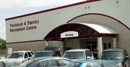
Tavistock
Tavistock is located 15 kilometers southeast of Stratford and five kilometers south of Shakespeare on County Road 59. The world championship crokinole tournament has been held annually since 1999 in Tavistock.
Tavistock is home to the Tavistock Braves, a junior hockey team that plays in the Midwestern Junior C Hockey League, and the Tavistock Royals, a senior hockey team that plays in the Western Ontario Athletic Association Senior Hockey League.
Tavistock has hosted the World Crokinole Championship (WCC) tournament annually on the first Saturday of June since 1999. Tavistock was chosen as the host village because it was closest to the Sebastopol, Ontario home of Eckhardt Wettlaufer, the maker of the earliest known board.{http://www.worldcrokinole.com/history.html}
Demographics
Population trend:
Private dwellings occupied by usual residents: 2514 (total dwellings: 2617)
Cassel Mennonite Church
696556 17th Line. The congregation was established in 1935.
Christ Church
595815 Oxford Road 59 N, Huntingford. The congregation was established in 1839 when a frame building was erected. The current church was built in 1950.
East Zorra Mennonite (Amish)
677044 16th Line. The congregation was established in 1837.
Grace United Church
116 William St, Tavistock. The original congregation was established in the 1840s. A wooden frame church was built in 1870 as Zion Evangelical. The current brick church which was built in 1904. The congregations from Zion and South Easthope Churches, Knox United Church and Harmony United Church united in 1969. An addition was built in 1980.
Hebron United Church
676241 16th Line. The congregation was established in 1843 and the current church was built in 1899.
Hickson United Church
596243 Highway 59, Hickson. It opened in 1902 as a Wesleyan Methodist Church and joined the United Church in 1925.
Innerkip Presbyterian Church
153 Blandford St, Innerkip. The congregation was established in 1852. The newest church opened in 2007.
Innerkip United Church
11-13 Vincent St, Innerkip. Worship meetings of this Methodist congregation began in 188 and a new brick church opened in 1887. It joined the United Church in 1925.
South Zorra Baptist Church
615433 13th Line. It was established and built in 1870.
St Matthews Lutheran Church
965565 Maplewood Sideroad. Services began in 1852, and the current church was built in 1866. It is the oldest Lutheran church in East Zorra.
St. Paul's Evangelical Lutheran Church
17 Wellington St, Tavistock. Dedicated in December 1882.
Tavistock Mennonite Church
129 Wettlaufer, Tavistock. Built in 1942.
Trinity Anglican Church
596682 Oxford Road 59. Consecrated on June 14, 1861. It closed in 1967, but a minister from the Church of the Good Shepherd holds a service in the old church once a year.
Amish Mennonite Cemetery
985992 Perth-Oxford Rd. This cemetery was opened before the East Zorra Mennonite Cemetery, ca. 1840s. The stones have been moved to one end of the cemetery.
East Zorra Baptist Cemetery
924947 Cassell Sideroad. The earliest burial recorded was in 1853.
East Zorra Mennonite Cemetery
677044 16th Line. The congregation was established in the 1850s. There is a church beside the cemetery.
East Zorra Municipal (Brickyard) Cemetery
656981 15th Line. The adjoining farm owners donated this cemetery in 1857. The only burials being made there now are from the People Care Centre in Tavistock when there are no relatives to claim the deceased.
Grace United Cemetery
42 William St., Tavistock. Associated with Grace United Church in Tavistock.
Huntingford Anglican Cemetery
595815 Oxford Road 59. The church (Christ Church) associated with the cemetery was built in 1839.
Innerkip Cemetery
Main St/James St, Innerkip. It was transferred from a private family cemetery to the Innerkip Cemetery Company for use by the community in 1873.
New Evangelical United Brethren Cemetery
696556 17th Line. The New cemetery was opened when the old church burned down and a new one was built. There are some burials from Hebron United Church on the south side of the cemetery.
St. Matthew's Lutheran Cemetery
965565 Maplewood Sideroad. Associated with St. Matthew's Lutheran Church, which was built in 1866. Burial records date to the 1850s.
St. Paul's Evangelical Lutheran
Roth St., Tavistock. A half-acre was made available for cemetery use at the Grand Trunk Railway tracts in 1882.
Trinity Anglican Cemetery
596682 Oxford Road 59. Consecrated at the same time as the church on June 14, 1861; however, the first burial was in 1849.
Vandecar Cemetery
515887 11th Line. A pioneer cemetery, its earliest burial was in 1848. Many of the older tombstones have been placed in a central cairn.
Innerkip Central Public School
180 Coleman St, Innerkip. The first school which was originally built in 1930 has since been replaced with a more modern facility.
Tollgate Central Public School
744993 Oxford Road 17. It was originally called S.S. No. 4 and was built on this site in 1848. A more modern facility has since been built (1954).
The Glass Swan
52 Woodstock St. S., Tavistock. There is a plaque commemorating the historic house from Tavistock's earliest days.
Innerkip Lions Park
695566 Oxford Road 5, Innerkip. 6.9 ha (17 acres).
Optimist Club of Tavistock Park
250 Oxford Road 59, Tavistock. 4.5 ha (11 acres)
Tavistock Queen's Park
Maria St. Established in 1928. The stone gates were funded by the local Women's Institute. 20.5 ha (50 acres) of parkland and facilities.
W. Leslie Dickson Arboretum
715570 Oxford Road 4. Dedicated to the memory of W.L. Dickson. This little 6 ha (20 acres) jewel is a product of a group called "The Men of the Trees". They have worked very hard to provide in excess of 150 labeled native trees and shrubs.
Canada's Birthday
986044 Perth-Oxford Rd. Plaque - located at Punkeydoodle's Corners. a 6-sided concrete pillar with the inscription "Canada's Birthday 1982". It commemorates the Rt. Honourable Joe Clark's visit to the community on this day.
David Stock, Caister's Tavern
597112 Oxford Road 59, Tavistock. Caister's Tavern ca. 1845-1854. Caleb Caister came from England to Oxford County in 1833. In 1836, he settled on this site, cleared farmland and built a one-storey log dwelling. This dwelling was his family home but also served as an inn and tavern. Until 1848, when what is now Tavistock was established, Caister's home was the only public accommodation in north-central Oxford County for pioneers moving along the Huron Road and thence southerly into the Zorra settlement. By the 1840s Caister held an official municipal licence, and a survey map of the time shows that his log dwelling was known in this locality as Caister's Tavern.
Founder of Tavistock
22 Woodstock St. S, Tavistock. A stone cairn erected 1930 in memory of Captain Henry Eckstein, founder of Tavistock, A.D. 1848. Rededicated 1948. Rebuilt and rededicated in 1998.
A Tribute to Farm Women
OMAFRA site - Outdoor Farm show. This monument represents the role of farm women in the foundation and progress of Canadian Agriculture. Women from across the nation brought stones from their farms to help build this structure, erected throughout the three days of Canada's Outdoor Farm Show, September 2000. Presented by Farm Credit Corporation, Canada's Outdoor Farm Show, Ontario Farm Women's Network.